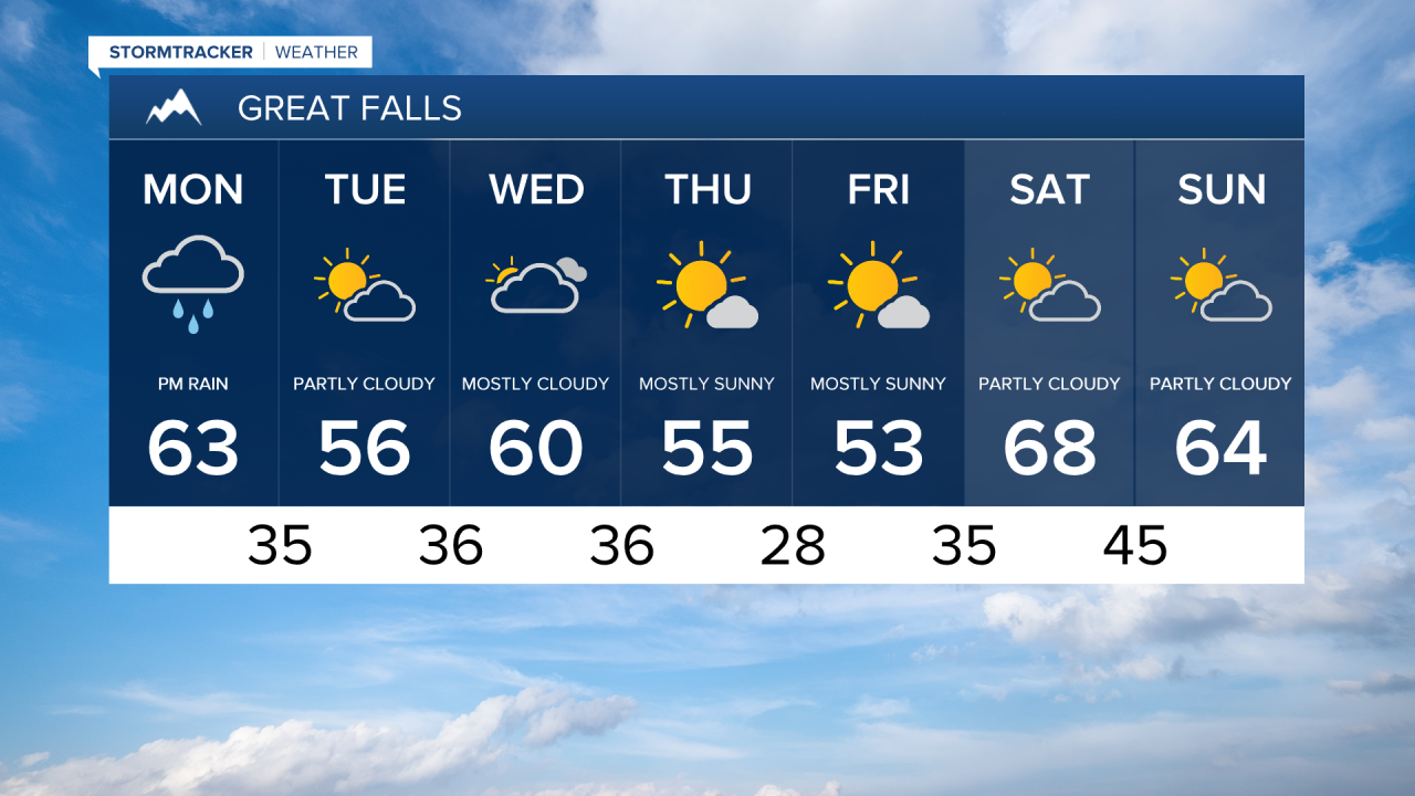
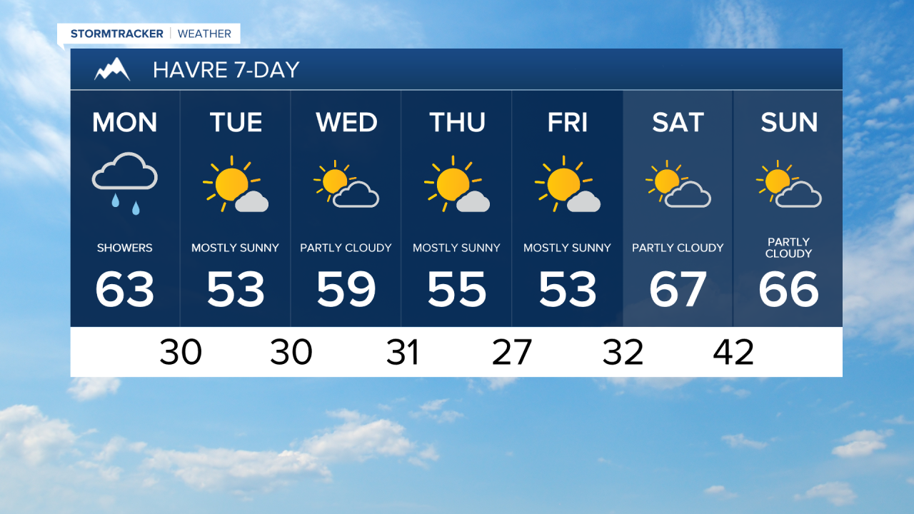
After a spectacular weekend of weather, aside from some gusty winds, clouds are starting to creep in ahead of an approaching cold front. The week ahead is going to bring cooler temperatures, along with a few chances for rain and mountain snow.
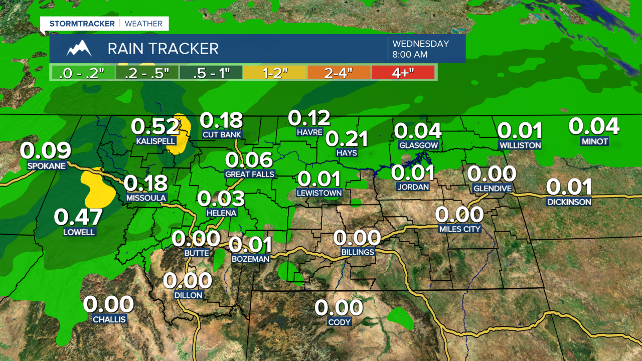
Today, a disturbance moving eastward from the Pacific Northwest will pass just north of our area. Throughout the afternoon and evening, rain and mountain snow will move in from west to east. Rainfall is expected to be light, with totals around 0.1-0.25" for the Hi-Line and less than 0.1" for most of north central Montana. Northwest Montana, including Glacier National Park, is likely to see the highest precipitation amounts, with snowfall of 1-3" possible at elevations above 5000 feet. Travel impacts should be limited.

Temperatures cool below average on Tuesday, staying cool with highs in the 50s through the end of the week. Expect sunny and pleasant conditions on Tuesday, transitioning to more clouds on Wednesday as another disturbance moves through the area. A few showers may develop Wednesday afternoon and linger through Thursday morning.

After that, highs rebound back into above-average territory for the weekend. Saturday will feature pleasant weather and plenty of sunshine. However, it does appear and upper-level trough will move into the area Sunday into Monday, potentially bringing in cooler and wetter conditions to the region.