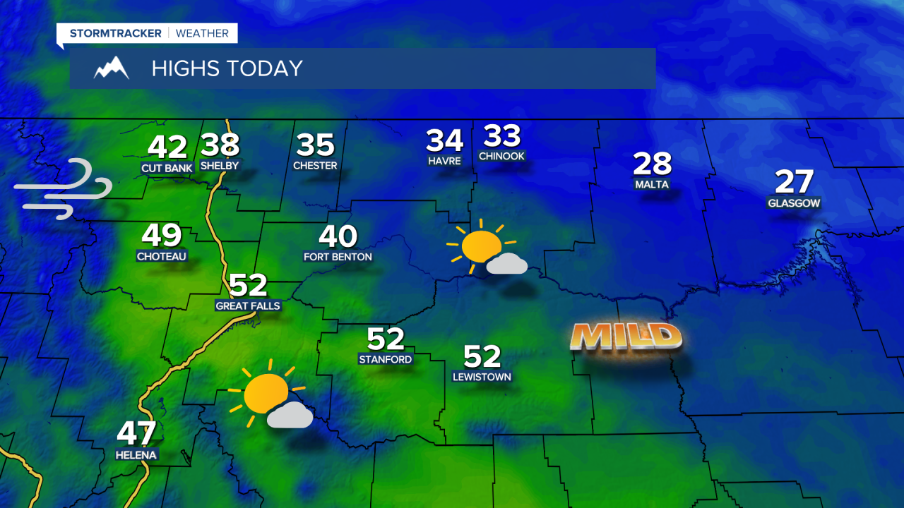
It's Friday eve, and we’re in for a spectacular day of weather! However, some areas, particularly in the Golden Triangle around Shelby, are waking up to dense fog, leading to brief reductions in visibility below half a mile. As the day progresses, expect the fog to lift, giving way to sunny and warmer conditions. Highs will range from the upper 20s to mid 30s on the Hi-Line, while central Montana will enjoy temperatures in the mid 40s to low 50s.
As evening approaches, winds will begin to pick up along the Rocky Mountain Front, with gusts potentially exceeding 40 mph overnight. The strongest winds will arrive on Saturday afternoon and evening as a cold front sweeps through. A High Wind Watch is in effect from 2:00 AM Saturday to 2:00 AM Sunday for the East Glacier Park and Rocky Mountain Front areas, where gusts could reach up to 80 mph. Areas further east across the plains, particularly between Great Falls and Lewistown, might also see wind gusts topping 60 mph.


On Saturday, snow will start to blanket the mountains along and west of the Continental Divide, with several inches accumulating in higher elevations of Glacier National Park. As the system moves east, snow will shift toward central Montana mountain ranges by Sunday into Sunday night. Plains will see a mix of rain and snow, with light accumulations expected in lower elevations and heavier snowfall in the Little Belts and Highwoods.