

A LAKE WIND ADVISORY is in effect for Fort Peck Lake from 6am until 9pm Friday.

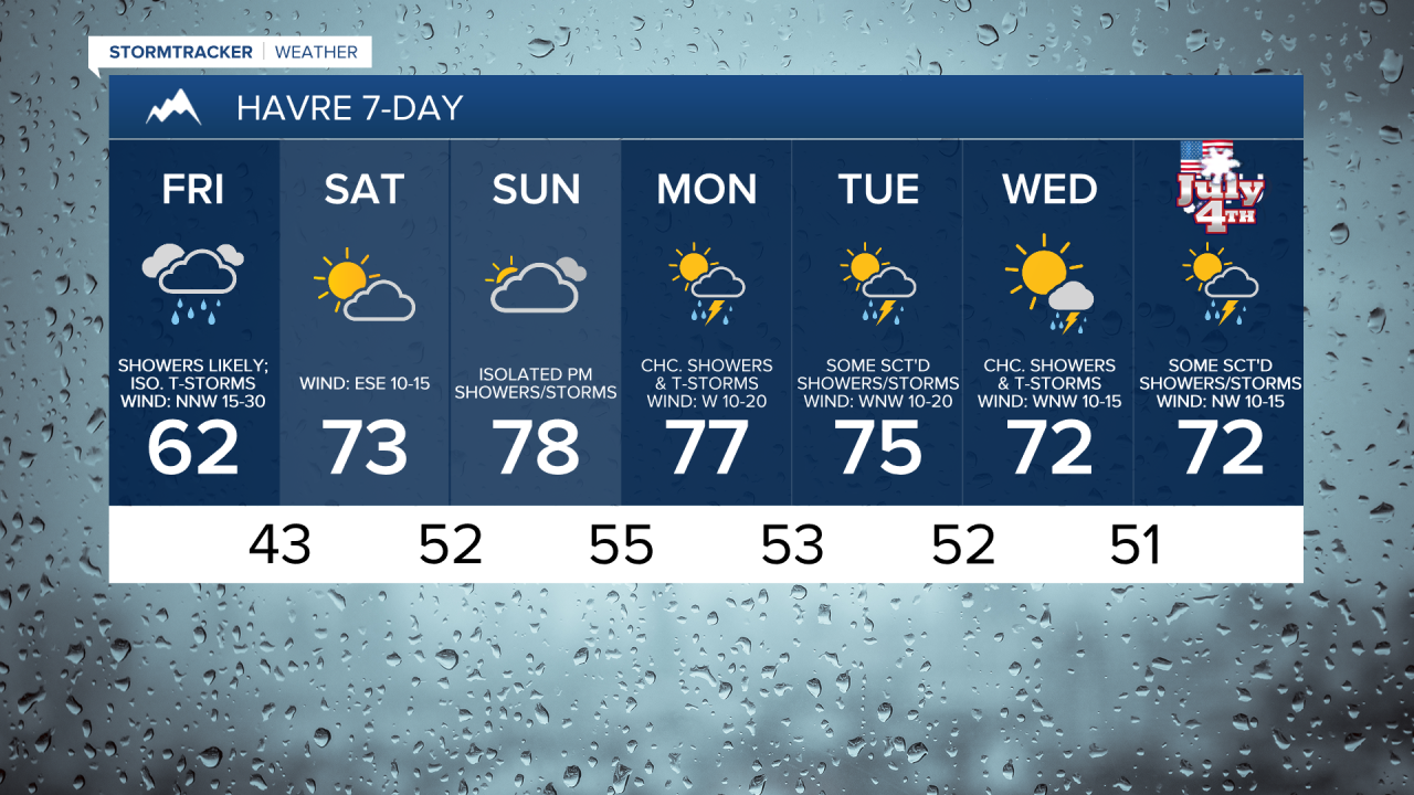
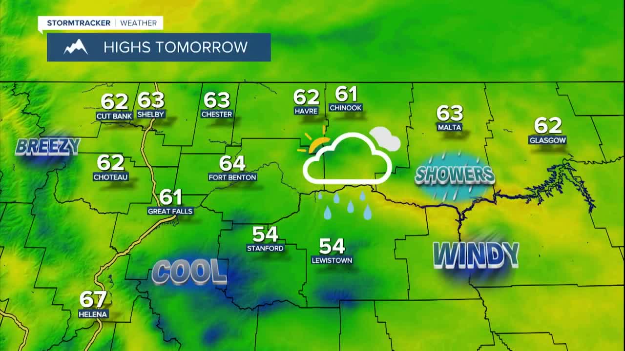
Severe thunderstorms will move out of eastern Montana and into western North Dakota this evening. There are then going to be some scattered showers and isolated thunderstorms around tonight, generally after midnight, as some wrap-around moisture from a storm system off to our north begins to work its way into Montana. Showers and isolated thunderstorms are then likely tomorrow, especially during the morning and especially in north-central Montana, as this storm system continues to impact our area. We are also going to have partly cloudy skies tonight, with the cloud cover increasing as the night goes on, and we are going to have mostly cloudy skies tomorrow, with the cloud cover decreasing some later in the day.
It is also going to be windy this evening and tonight along the Rocky Mountain Front as sustained wind speeds are going to be between 20 and 40 mph, and wind gusts over 50 mph are possible. East of the Rocky Mountain Front, we are going to have gusty winds around this evening and tonight as sustained wind speeds are going to be between 10 and 30 mph, and wind gusts over 40 mph are possible. Widespread gusty to strong winds are then expected tomorrow as sustained wind speeds are going to be between 15 and 35 mph, and wind gusts over 50 mph are possible. The strongest wind tomorrow is going to be in locations east of I-15, and the wind is going to gradually decrease from west to east as we go through tomorrow afternoon and evening.
Cool temperatures are also expected tonight and tomorrow as lows tonight are going to be in the mid to upper 40s and low to mid 50s, and highs tomorrow are only going to be in the mid to upper 50s and low to mid 60s.
We are then going to have nice weather on Saturday as we are going to have partly cloudy skies, dry conditions, just a bit of a breeze (sustained wind speeds between 5 and 20 mph), and pleasant temperatures as highs are going to be in the 70s and low 80s in most locations.
On Sunday, we are going to have mostly cloudy skies with some scattered showers and thunderstorms around, generally during the afternoon and evening and especially in the mountains and around Helena, as a disturbance passes through our area. It is also going to be mild on Sunday as highs are going to be in the mid to upper 70s and low 80s in most locations.
There are then going to be some scattered showers and thunderstorms around on Monday, Tuesday, Wednesday, and Thursday, especially during the PM hours and especially along the Hi-Line, as we are going to be in an unsettled weather pattern with multiple disturbances passing through our area. We are also going to have partly to mostly sunny skies on these four days. It is also going to be breezy on Monday as sustained wind speeds are going to be between 10 and 25 mph. There is then going to be a little breeze around on Tuesday, Wednesday, and Thursday as sustained wind speeds are going to be between 5 and 20 mph. We are also going to have pleasant temperatures next week as highs are going to be in the upper 60s, 70s, and low 80s in most locations.