SYNOPSIS: We are going to have a good amount of sunshine, mostly dry conditions, little to no wind, and well above average temperatures for this time of year tomorrow through early next week as an upper-level ridge is going to be in control of our weather. Cooler and wetter weather is then expected for the middle and end of next week as an upper-level trough slowly passes through our area.

DAY-TO-DAY: We are going to have clear skies and dry conditions tonight. We are also going to have pleasant temperatures tonight as lows are going to be in the mid to upper 40s and low to mid 50s in most locations.
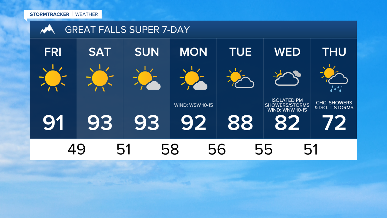
For tomorrow and Saturday, we are going to have lots of sunshine, dry conditions, and little to no wind. It is also going to be hot on these two days as highs are going to be in the mid to upper 80s and low to mid 90s. There is also going to be some haze around on these two days in southwestern and western Montana, including around Helena, due to smoke from wildfires burning in Idaho, and the air quality at times may be unhealthy for sensitive groups. Elsewhere, there is just going to be a little haze around on these two days with moderate to good air quality.
On Sunday, we are going to have partly to mostly sunny skies (via increasing clouds) with a few isolated PM showers and thunderstorms around, generally in the mountains around Helena, as a weak disturbance passes through our area. We are then going to have mostly sunny skies and mainly dry conditions on Monday and partly cloudy skies and mainly dry conditions on Tuesday. It is also going to continue to be hot on these three days as highs are going to be in the mid to upper 80s and low to mid 90s, and a couple new record high temperatures may be set over these three days. It is also going to be a little breezy in some areas on Monday and Tuesday as sustained wind speeds are going to be between 5 and 20 mph.
A few showers and thunderstorms are then possible on Wednesday, generally during the afternoon/evening, as a storm system begins to impact our area. There are then going to be some scattered showers and isolated thunderstorms around on Thursday as this storm system passes through our area. We are also going to have partly to mostly cloudy skies on these two days. The temperatures are also going to cool down some over these two days as highs are going to be in the 70s and 80s on Wednesday and highs are going to range from the mid 60s to the mid 80s on Thursday. There is also going to be a little breeze around in some areas on these two days as sustained wind speeds are going to be between 5 and 20 mph.