

An AIR QUALITY ALERT is in effect for portions of central and western Montana until at least 8am Tuesday.

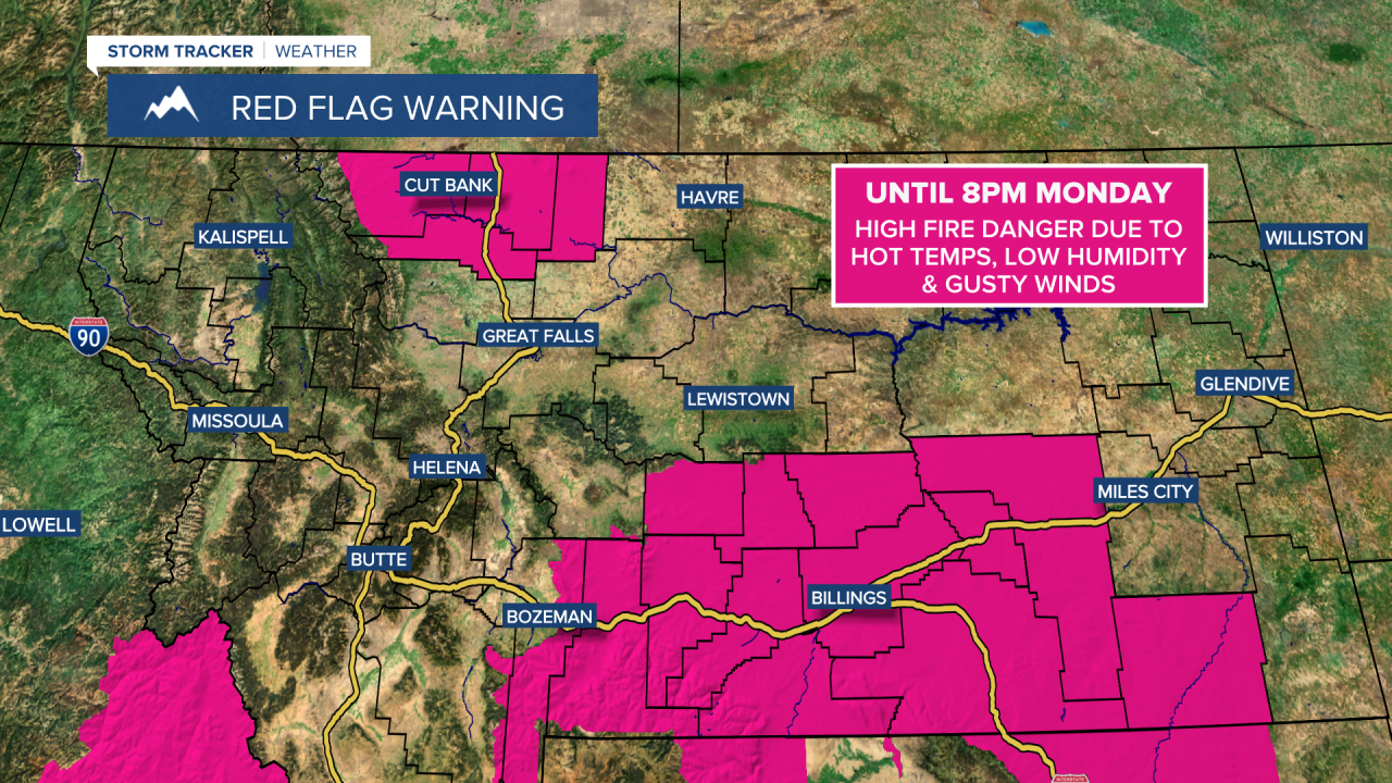
A RED FLAG WARNING is in effect for portions of north-central, south-central, and southeastern Montana until 8pm Monday.
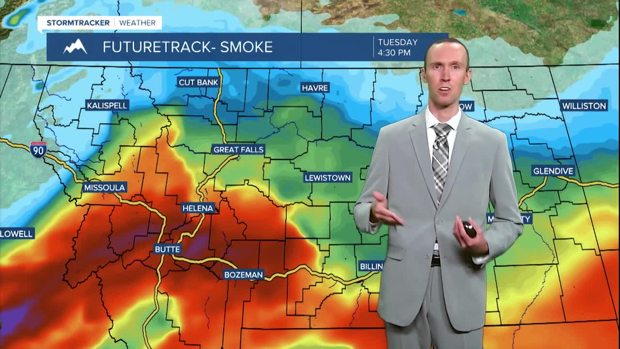
We have had smoky skies and poor air quality throughout the day today. As we go through this evening and tonight, the thickest smoke and the worst air quality is going to shift into eastern and southern Montana. In northern and portions of central Montana, the smoke will decrease and the air quality will improve some as the night goes on.
For tomorrow, it is going to be another smoky day in southern Montana, with the worst of the smoke in southwestern Montana, and the air quality for most of tomorrow is going to be unhealthy for everyone or unhealthy for sensitive groups in this part of the state. In northern Montana, there is going to be widespread haze and some areas of smoke around tomorrow, and at times, the air quality may be unhealthy for sensitive groups. Overall though, the smoke and the air quality in northern Montana won’t be as bad tomorrow as it was today. The haze and smoke will then begin to clear out for everyone on Wednesday as a storm system begins to impact our area.
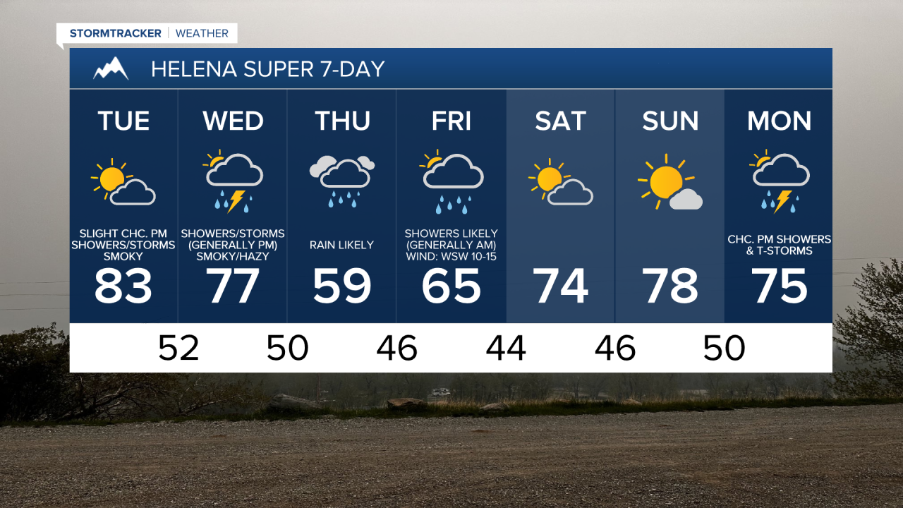
We are going to have partly cloudy to mostly clear skies and mainly dry conditions tonight. We are also going to have pleasant temperatures tonight as lows are going to be in the mid to upper 40s and low to mid 50s. The wind is also going to diminish this evening, with just a light breeze overnight.
We are then going to have increasing clouds tomorrow with a couple isolated showers and thunderstorms around during the evening. It is also going to be cooler tomorrow than it was today as highs are going to be in the mid to upper 70s and low to mid 80s in most locations.

On Wednesday, we are going to have mostly cloudy skies with scattered showers and thunderstorms around, generally during the afternoon/evening and generally in western and central Montana, as a storm system begins to impact our area. Widespread showers and isolated thunderstorms are then likely on Thursday and Friday in central and western Montana as this storm system slowly passes through our area. As we go through Friday, the precipitation will gradually taper off from west to east as the day goes on. In eastern Montana, there will be a few showers and thunderstorms around Wednesday through Friday, but most of the precipitation with this storm system is going to miss the eastern part of the state.
There is still a lot of uncertainty with rainfall totals with this storm system, but there is a good chance that a lot of locations in central and western Montana will receive at least a half inch of rainfall from Wednesday through Friday. Most locations in eastern Montana will likely receive less than a tenth of an inch of precipitation through Friday evening.
We are also going to have overcast skies on Thursday and mostly cloudy skies on Friday, with some decrease in the cloud cover during the second half of Friday. On Wednesday, highs are going to be in the 70s and low to mid 80s, with the warmest temperatures in northeastern Montana. We are then going to have a wide range of temperatures on Thursday as highs are going to range from the mid 50s to the low 80s, with the warmest temperatures in northeastern Montana. It is then going to be cool for everyone on Friday as highs are going to be in the 60s in most locations. There is also going to be a bit of a breeze around on Thursday as sustained wind speeds are going to be between 10 and 20 mph, and it is going to be breezy on Friday as sustained wind speeds are going to be between 10 and 25 mph.
Much nicer weather is then expected this weekend as we are going to have partly cloudy skies and dry conditions on Saturday and mostly sunny skies and dry conditions on Sunday. It is also going to be warmer this weekend than it is going to be later this week as highs are going to be in the 70s and low 80s in most locations. There is also going to be a little breeze around on Saturday as sustained wind speeds are going to be between 10 and 20 mph.
Unsettled weather is then expected for most of next week with multiple chances of precipitation and near to below average temperatures for this time of year.