We are going to have increasing clouds tonight with some isolated showers and thunderstorms and thunderstorms around, especially in the mountains. It is also going to be mild tonight as lows are going to be in the upper 50s and low to mid 60s. Hazy skies are also expected tonight, especially in western portions of north-central Montana and around Helena.
For tomorrow, we are going to have partly cloudy skies with some scattered showers and thunderstorms around, especially in locations east of I-15, as a disturbance passes through our area. Tomorrow is also going to be the cloudiest and wettest day of the next week. It is also going to be very warm to hot again tomorrow as highs are going to be in the mid to upper 80s and low to mid 90s in most locations. Hazy skies are also expected tomorrow.
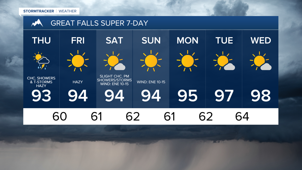
We are then going to have mostly sunny skies on Friday and Saturday with mainly dry conditions expected on Friday and some isolated PM showers and thunderstorms around on Saturday, generally in the mountains. It is also going to be hot on these two days as highs are going to be in the 90s and upper 80s. There is also going to be a bit of a breeze around in some areas on Saturday as sustained wind speeds are going to be between 10 and 20 mph.
Lots of sunshine and mainly dry conditions are then expected Sunday through Wednesday as an upper-level ridge is going to be in complete control of our weather. It is also going to be very hot on these four days as highs are going to be in the upper 80s, 90s, and 100s, with Tuesday and Wednesday being the warmest days. There is also going to be a bit of a breeze around on Sunday as sustained wind speeds are going to be between 10 and 20 mph.