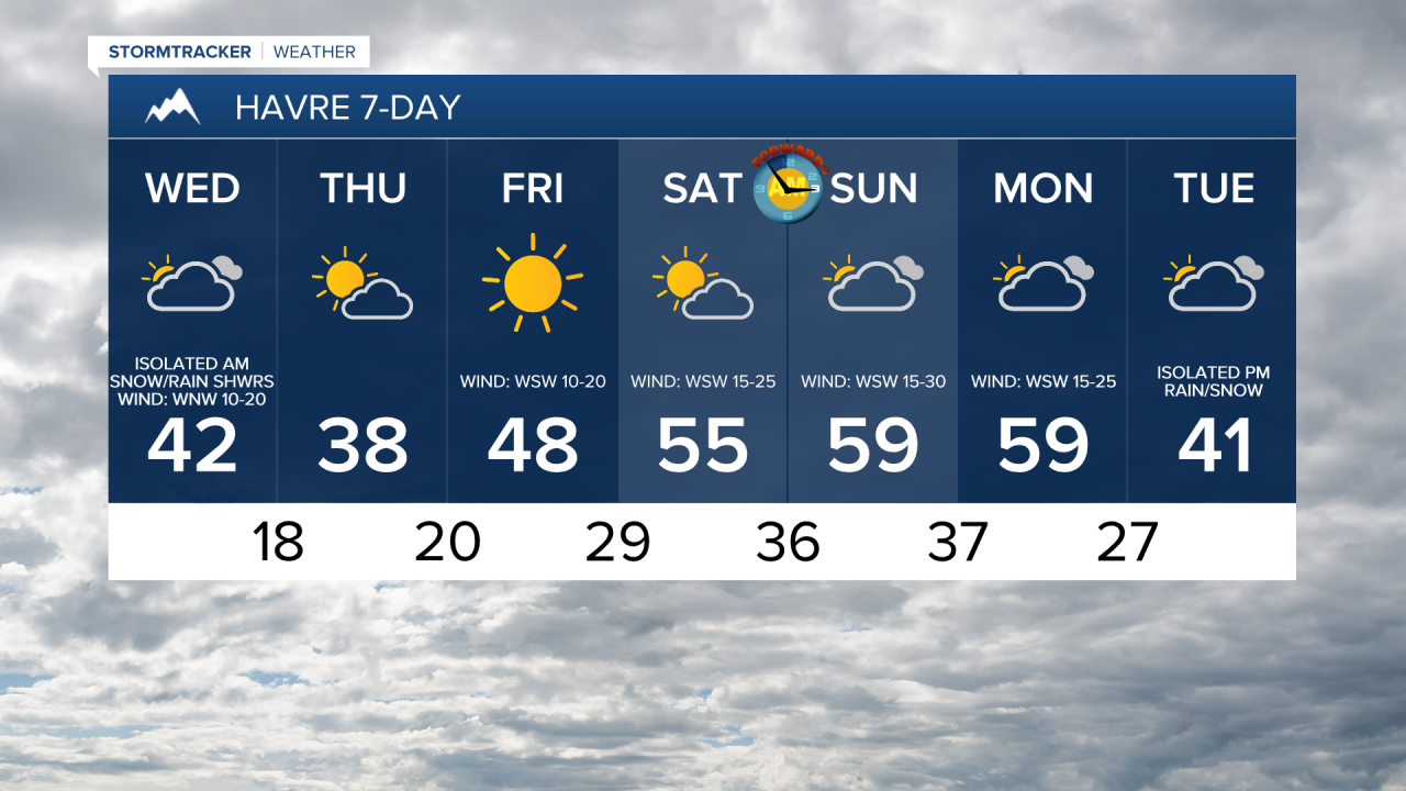
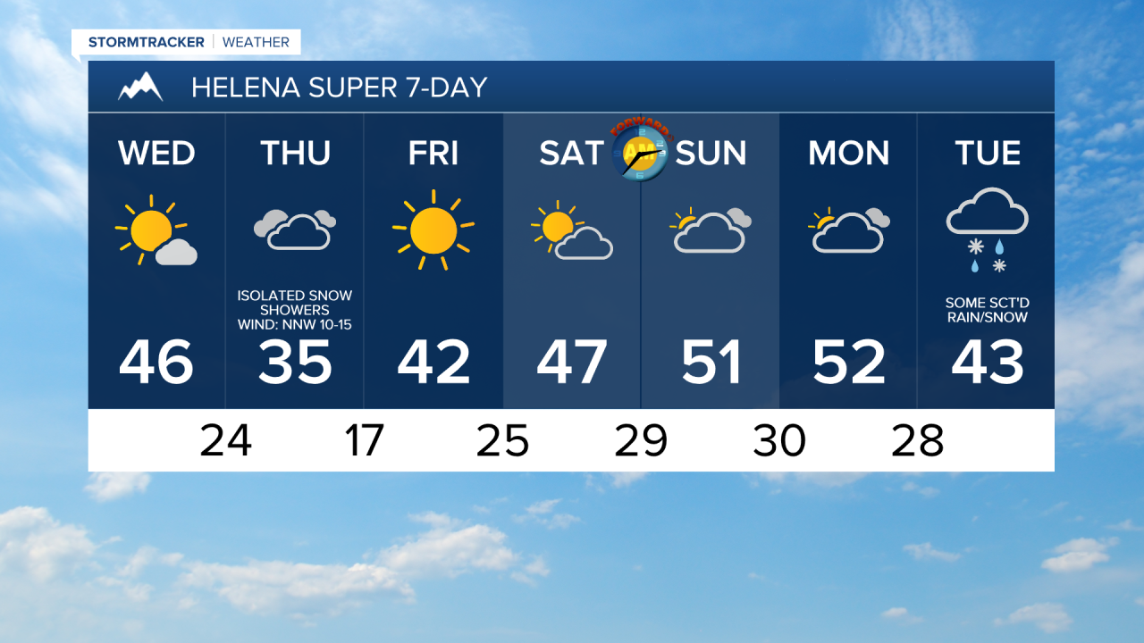
We are going to have partly to mostly cloudy skies tonight with a few snow and rain showers around, generally after midnight and especially in the mountains and along the Hi-Line, as a disturbance begins to pass through our area. We are also going to have increasing wind during the second half of tonight, and it is going to be cool tonight as lows are going to be in the 20s and low 30s in most locations.
For tomorrow, we are going to have partly to mostly cloudy skies along the Hi-Line and partly to mostly sunny skies south of the Hi-Line. There are also going to be a few snow and rain showers around tomorrow, generally during the morning and generally along the Hi-Line and in the mountains, as tonight’s disturbance leaves our area. Widespread breezy conditions are also expected tomorrow as sustained wind speeds are going to be between 10 and 25 mph, and wind gusts up to 40 mph are possible. It is also going to be warmer tomorrow than it was today as highs are going to be in the 40s and upper 30s in most locations.
On Thursday, we are going to have mostly to partly cloudy skies and mainly dry conditions in north-central Montana and overcast skies with a few snow showers around Helena, especially in the higher terrain around and south of town, as a storm system passes by our area to the south. Thursday is also going to be the coolest day of the next week as highs are only going to be in the 30s and low 40s. It is also going to be a little breezy on Thursday in the Helena area as sustained wind speeds are going to be between 5 and 20 mph.
We are then going to have beautiful weather on Friday as we are going to have lots of sunshine, dry conditions, and warmer temperatures as highs are going to be in the 40s and low 50s in most locations. It is also going to be breezy on Friday east of the Rocky Mountain Front as sustained wind speeds are going to be between 10 and 20 mph, and it is going to be gusty on Friday along the Rocky Mountain Front as sustained wind speeds are going to be between 15 and 30 mph.
Mild temperatures return for this weekend and Monday as highs are going to be in the mid to upper 40s and low to mid 50s on Saturday and the 50s and low to mid 60s on Sunday and Monday. These mild temperatures are going to be accompanied by a lot of wind through. On these three days, it is going to be very windy along the Rocky Mountain Front as sustained wind speeds are going to be between 20 and 40 mph, and wind gusts over 60 mph are possible. East of the Rocky Mountain Front, it is going to be gusty/windy on these three days as sustained wind speeds are going to be between 10 and 30 mph, and wind gusts up to 50 mph are possible. In the Helena valley, there is just going to be a little breeze (5-20 mph) around on these three days.
There is then going to be some scattered rain/snow around on Tuesday, generally during the afternoon/evening, as a disturbance begins to impact our area. It is also going to be cooler on Tuesday as highs are going to be in the upper 30s and low to mid 40s in most locations.