A WINTER STORM WATCH is in effect for northeastern Montana from 5pm Saturday until 11pm Sunday.

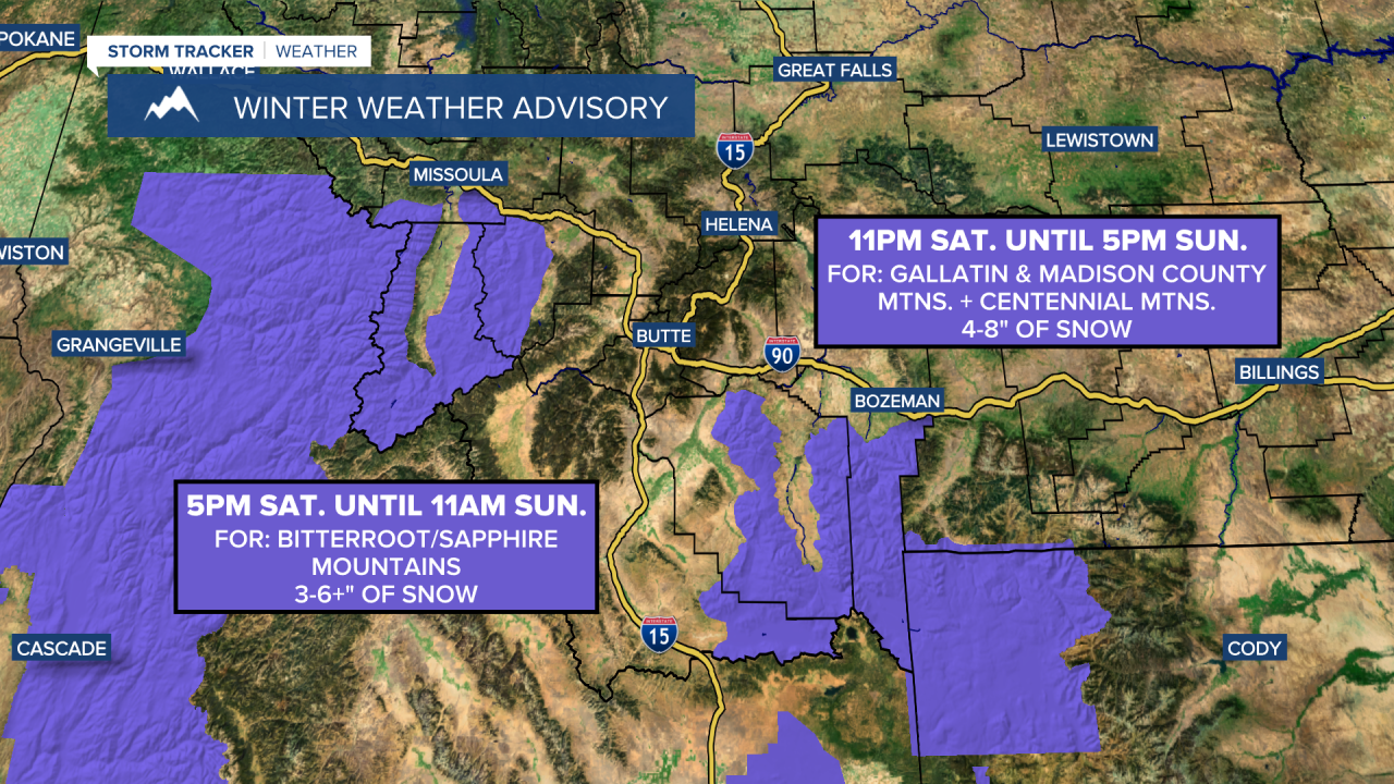
A WINTER WEATHER ADVISORY is in effect for the Bitterroot and Sapphire mountains from 5pm Saturday until 11am Sunday.
A WINTER WEATHER ADVISORY is in effect for the Gallatin and Madison County mountains as well as the Centennial mountains from 11pm Saturday until 5pm Sunday.

Gusty winds are expected tonight and tomorrow along the Rocky Mountain Front as sustained wind speeds are going to be between 15 and 30 mph. It is also going to be breezy in some areas east of the Rocky Mountain Front, especially in and around Cascade County, tonight and tomorrow as sustained wind speeds are going to be between 10 and 25 mph. We are also going to have increasing clouds tonight and mostly cloudy skies tomorrow. It is also going to be chilly tonight as lows are going to range from the single digits and low teens along the eastern half of the Hi-Line to the upper 20s and low 30s in central Montana. We are then going to have pleasant temperatures tomorrow as highs are going to be in the mid to upper 30s, 40s, and low 50s.
Mostly dry conditions are expected during the daylight hours tomorrow. Some rain/freezing rain/snow will then begin to develop tomorrow evening, with scattered areas of rain, freezing rain, and snow around tomorrow night, especially in locations south of the Hi-Line. There are then going to continue to be scattered areas of snow, freezing rain, and rain around on Sunday, but this precipitation will taper off from west to east as the day goes on. We are also going to have mostly cloudy skies on Sunday, with the cloud cover decreasing some during the second half of the day.
There is a ton of uncertainty with just how widespread the precipitation is going to be this weekend in central and north-central Montana, which means there is also a ton of uncertainty regarding ice and snow amounts. As of right now, these are the snow and ice amounts that I think are possible this weekend.
In the mountains in central Montana, 3-8” of snow accumulation is possible, and in the lower elevations near the mountains in central Montana, including Lewistown, 1-4” of snow accumulation is possible. Elsewhere, including in Great Falls and Helena, less than 1” of snow accumulation is expected. In terms of ice amounts, the highest ice amounts look to be in northeastern Montana, where up to .2” of ice accumulation is possible. Elsewhere, up to a few hundredths of an inch of ice accumulation is possible. Be prepared for snow-covered roads at and above mountain pass level from tomorrow evening through Sunday. In the lower elevations, be prepared for slippery roads in some areas tomorrow night and Sunday.

Widespread gusty winds are also expected on Sunday as sustained wind speeds are going to be between 10 and 30 mph, and wind gusts over 40 mph are possible. We are also going to have cooler temperatures on Sunday as highs are going to be in the mid to upper 30s and low 40s in most locations.
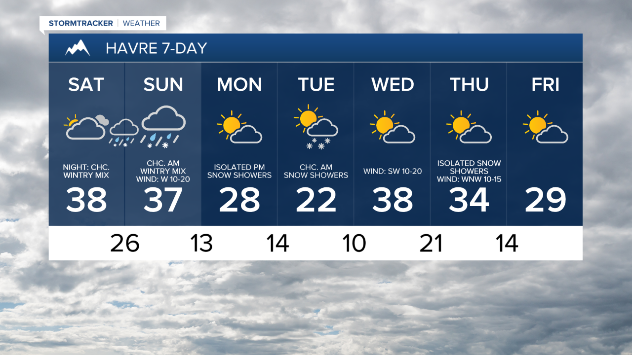
There are then going to be some scattered snow showers around from Monday afternoon through Tuesday morning as another disturbance passes through our area, and light snow accumulations are possible. We are also going to have partly to mostly cloudy skies on these two days. It is also going to be chilly on these two days as highs are going to be in the 20s and 30s in most locations. There is also going to be a little bit of a breeze around on these two days as sustained wind speeds are going to be between 5 and 20 mph.
On Wednesday, we are going to have partly to mostly cloudy skies and mostly dry conditions. There are then going to be a few snow and rain showers around on Thursday, generally in locations east of I-15, as another disturbance passes through our area. We are also going to have partly cloudy skies on Thursday. Partly cloudy skies and mainly dry conditions are then expected on Friday as high pressure is going to be in control of our weather.
Warmer temperatures are also expected from Wednesday through Friday as highs are going to be in the 30s and 40s in a lot of locations. However, in northeastern Montana, it will continue to be cold with highs in the 20s. Gusty winds are also expected in some areas on Wednesday as sustained wind speeds are going to be between 10 and 30 mph. Less wind is then expected on Thursday and Friday.


