Good afternoon everyone.
We are looking to have an active weather day tomorrow with severe weather across Montana and the Dakotas. The main threats will be isolated tornadoes, 2 inch plus size hail and damaging wind gusts. Please stay weather aware tomorrow. Especially if you are in the High Risk area.

This is all thanks to a cold front that will start to move tomorrow morning.

As the front moves across the Treasure State, our atmosphere will become increasingly unstable allowing for strong storms to develop in the early afternoon and last through the evening.


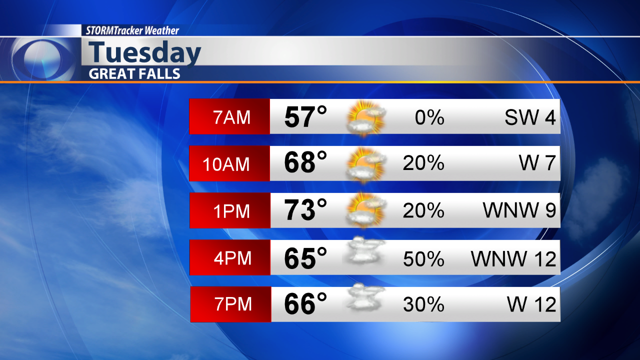
Here's a look at your Tuesday City Day Planner for Great Falls and Helena.


