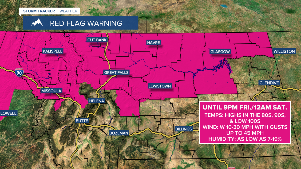
A RED FLAG WARNING is in effect for northern Montana until 9pm/12am Friday night. Critical fire weather conditions are expected due to the combination of very warm to hot temperatures, gusty to strong winds, and low relative humidity, so please do your part to not start any new fires.
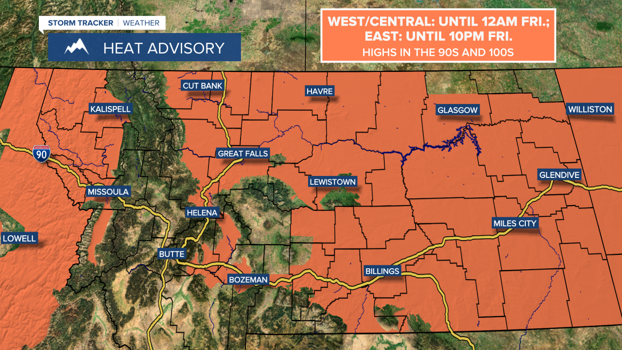
A HEAT ADVISORY is in effect for portions of western and central Montana until 12am Friday and for most of eastern Montana until 10pm Friday due to warm nighttime temperatures and hot daytime temperatures.
An AIR QUALITY ALERT is in effect for portions of western Montana until at least 12pm Friday. The air quality is going to be unhealthy for everyone or unhealthy for sensitive groups at times.
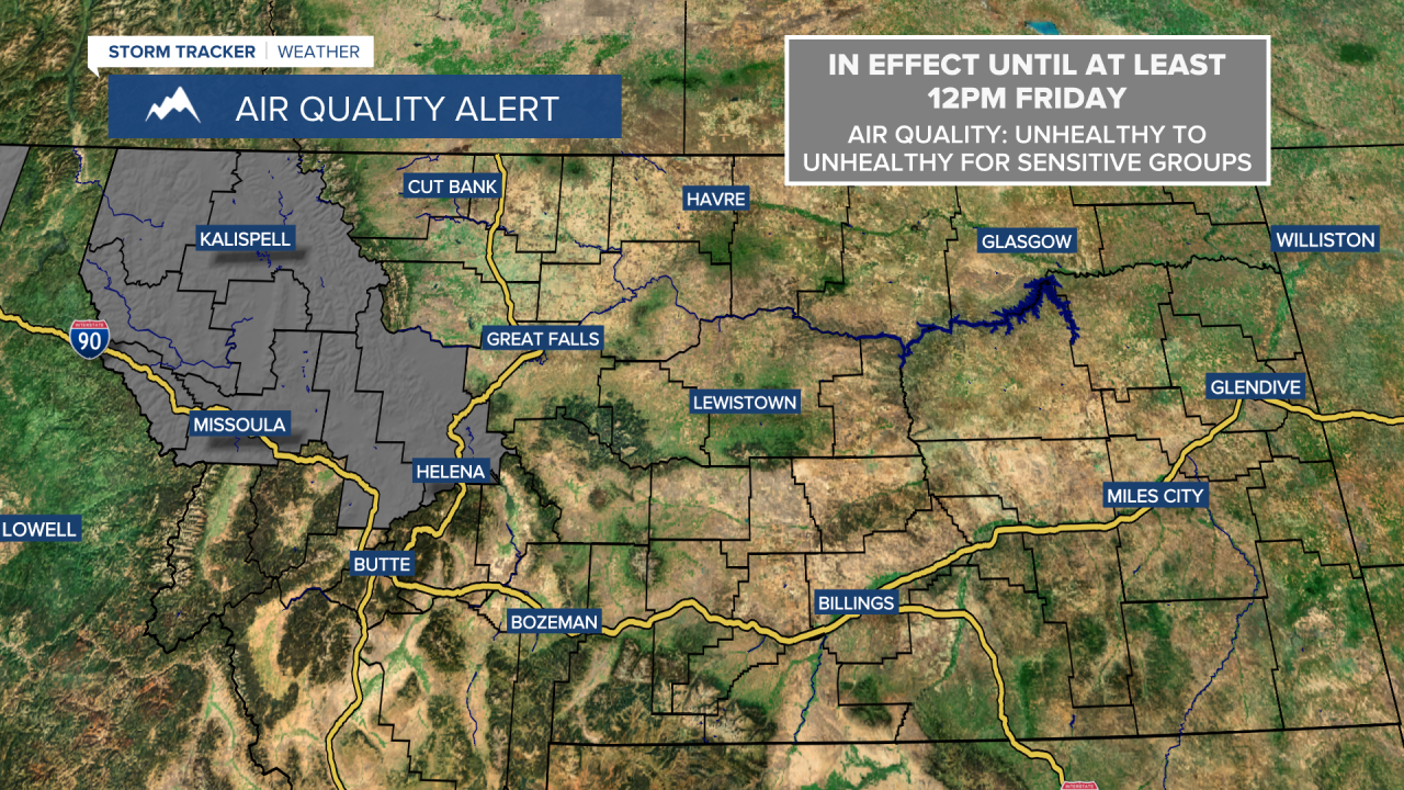
Widespread haze and areas of smoke will continue to impact Montana for the next couple of days. The air quality will fluctuate over the next few days as well. At times, the air quality will be good, while at other times the air quality will be unhealthy for sensitive groups or even unhealthy for everyone. Gradual improvement in the haze and smoke is expected as we head into this weekend though.
We are going to have partly cloudy skies tonight, and there will be a few isolated showers and thunderstorms around tonight as well. It is also going to be mild tonight as lows are going to be in the 60s and low 70s, and there will be a breeze around tonight along the Rocky Mountain Front and along portions of the Hi-Line where wind gusts up to 40 mph are possible.
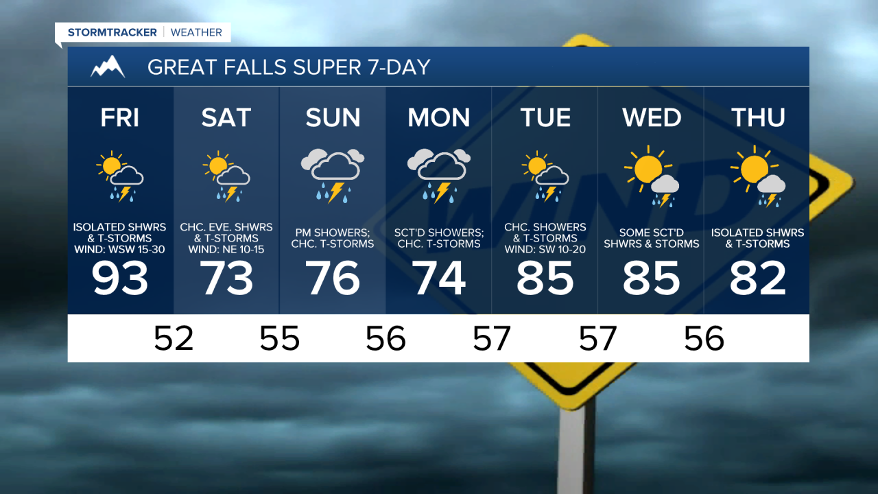
For tomorrow, we are going to have partly cloudy skies and there are going to be a few widely scattered showers and thunderstorms around, especially during the afternoon and evening, as some monsoonal moisture begins to work its way back into our area. It is also going to be hot again tomorrow, although it will be a little cooler than it was today as highs are going to range from the mid 80s to the low 100s, with the hottest temperatures in eastern Montana.
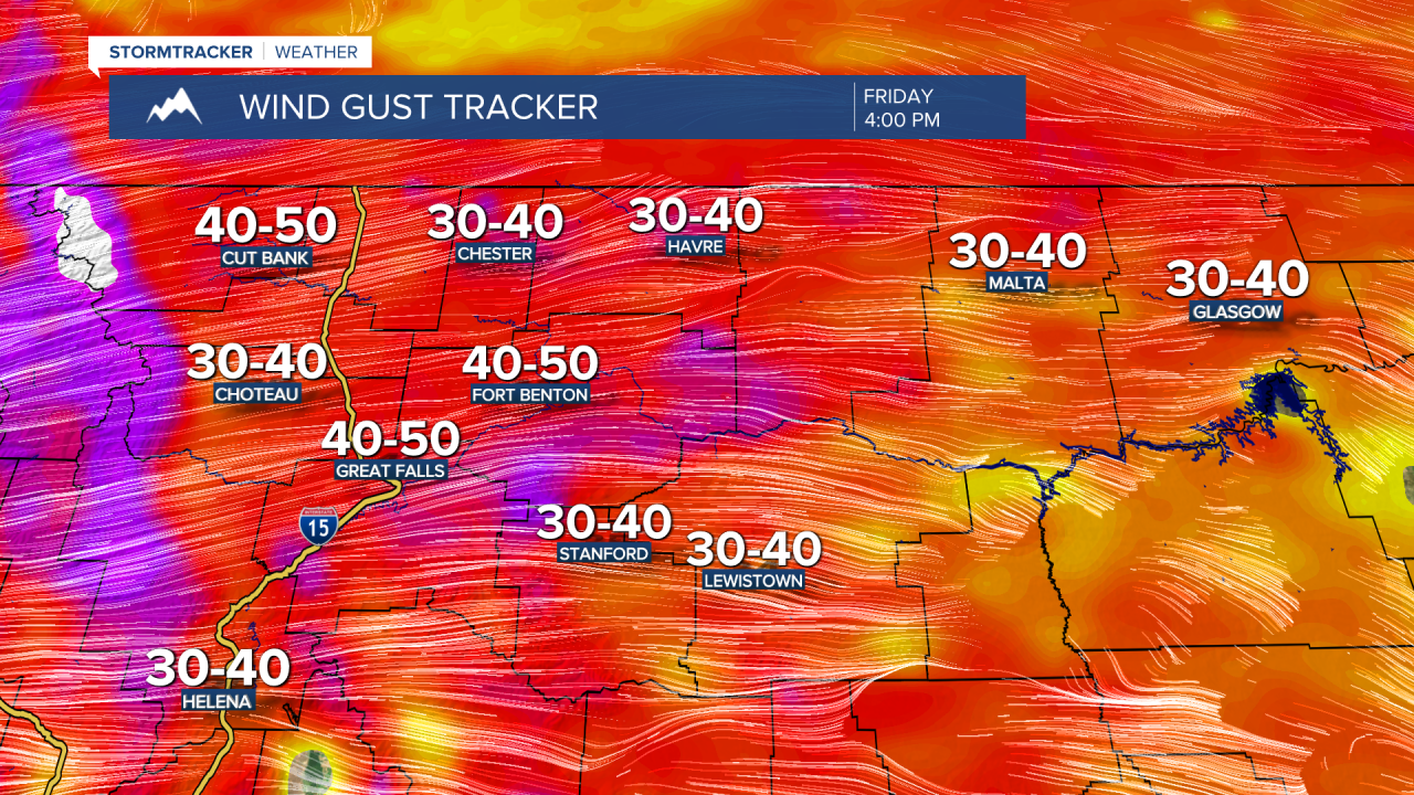
The big story tomorrow is going to be the wind though. It is going to be very windy tomorrow as sustained wind speeds are going to be between 15 and 30 mph in a lot of locations, and wind gusts over 50 mph are possible along the Rocky Mountain Front, while wind gusts over 40 mph are possible east of the Rocky Mountain Front. This wind combined with very warm to hot temperatures and low relative humidity is going to create extremely high fire danger tomorrow, so please do your part to not start any new fires.
On Saturday, we are going to have partly cloudy to mostly sunny skies with scattered showers and thunderstorms around during the afternoon and evening in southern and central Montana, including around the Helena and Lewistown areas. It is also going to be a lot cooler on Saturday than it is going to be tomorrow as highs are going to be in the 70s in a lot of locations. There is also going to be a bit of a breeze around on Saturday as sustained wind speeds are going to be between 10 and 20 mph.
On Sunday and Monday, we are going to have overcast skies and showers are likely, especially from Sunday evening through Monday morning. Some thunderstorms are also possible on these two days. It is also going to be cool on these two days as highs are going to be in the 70s in most locations.
Warmer temperatures are then expected on Tuesday, Wednesday, and Thursday as highs are going to be in the 80s and upper 70s in most locations. There are also going to be some scattered showers and thunderstorms around on Tuesday and Wednesday, and there are going to be some isolated showers and thunderstorms around on Thursday. We are also going to have partly cloudy to mostly sunny skies on these three days. It is also going to be breezy on Tuesday as sustained wind speeds are going to be between 10 and 20 mph.