We are going to have partly cloudy to mostly clear skies tonight with a few patchy areas of fog around. It is also going to be cool tonight as lows are going to be in the mid to upper 40s and low 50s in most locations. There is also going to be a breeze around tonight along the Rocky Mountain Front as sustained wind speeds are going to be between 10 and 20 mph.
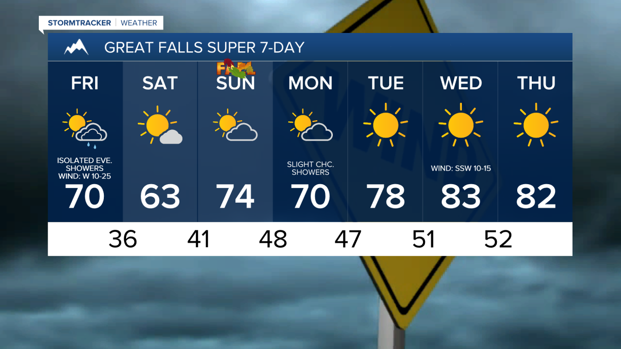
For tomorrow, we are going to have partly cloudy skies with a few scattered showers around during the afternoon/evening in north-central Montana, especially along the Hi-Line, as a disturbance passes through our area. Around Helena, we are going to have mostly sunny skies and mainly dry conditions tomorrow. Widespread gusty winds are also expected tomorrow as sustained wind speeds are going to be between 10 and 30 mph, and wind gusts over 40 mph are possible. Initially, this wind will be coming out of the southwest, but the wind direction will change to the west and then the northwest as we go through the day. Also, highs tomorrow are going to be in the 60s and low to mid 70s in most locations.
As we go through tomorrow night, the skies will clear out and the lingering showers will taper off as the disturbance leaves our area. The wind will also gradually diminish from west to east as the night goes on. It is also going to be chilly tomorrow night as lows are going to be in the 30s and low to mid 40s, and a frost/freeze is possible, especially in locations around and west of I-15, so please make sure you take the necessary precautions to protect any sensitive vegetation that you may have.
We are then going to have very nice fall weather this weekend (fall officially begins on Sunday at 6:43am MDT) as we are going to have mostly sunny skies and dry conditions on Saturday and partly cloudy skies and mainly dry conditions on Sunday. Saturday will be the cooler day of the weekend with highs in the low to mid 60s in most locations. A frost and/or freeze is then possible in some locations again Saturday night as lows are going to be in the 30s and low 40s. It is then going to be warmer on Sunday as highs are going to be in the upper 60s and low to mid 70s. There is also not going to be much wind around this weekend as sustained wind speeds are going to be between 5 and 20 mph.
On Monday, we are going to have partly cloudy skies with a few showers around, generally in locations east of I-15, as a disturbance passes through our area. There is also going to be a bit of a breeze around on Monday as sustained wind speeds are going to be between 10 and 20 mph. Also, highs on Monday are going to be in the mid to upper 60s and low to mid 70s in most locations.
We are then going to have beautiful weather on Tuesday, Wednesday, and Thursday, as we are going to have lots of sunshine, dry conditions, and above average temperatures for this time of year as highs are going to be in the mid to upper 70s and low 80s on Tuesday and the upper 70s and low to mid 80s on Wednesday and Thursday. It is also going to be a little breezy on Wednesday as sustained wind speeds are going to be between 5 and 20 mph.