Showers have been tapering off and the skies have been clearing out as we’ve gone through today as the storm system that brought widespread precipitation to Montana over the past two days continues to move further and further away from our area.
For this evening and tonight, we are going to have partly cloudy skies with just a couple showers/storms around, mainly before sunset. There is also going to be a breeze around this evening and tonight along the Rocky Mountain Front as sustained wind speeds are going to be between 10 and 20 mph. For everyone else, we are going to have decreasing wind this evening, with just a light breeze around overnight. It is also going to be cool tonight as lows are going to be in the 40s in most locations.
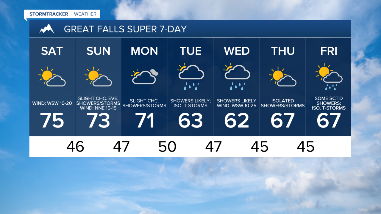
We are then going to have beautiful fall weather this weekend, so make sure you spend some time outdoors! Tomorrow, we are going to have partly cloudy skies, mainly dry conditions, and seasonable temperatures as highs are going to be in the 70s and upper 60s. On Sunday, we are going to have partly to mostly cloudy skies with some isolated showers and thunderstorms around, mainly during the afternoon/evening and generally in the mountains, as a disturbance begins to impact our area. We are also going to have a wide range of temperatures on Sunday as highs are going to range from the mid 60s to the mid 80s, with the warmest temperatures in northeastern Montana.
Gusty winds are also expected tomorrow along the Rocky Mountain Front as gusts over 40 mph are possible, and it will be a bit breezy tomorrow in some other areas as sustained wind speeds are going to be between 10 and 20 mph. There is then just going to be a little breeze around on Sunday as sustained wind speeds are going to be between 5 and 20 mph.
On Monday, we are going to have mostly cloudy skies with a few scattered showers/storms around, generally around Helena and in the mountains, as a disturbance passes through our area. We are also going to have a wide range of temperatures again on Monday as highs are going to range from the upper 60s to the mid 80s, with the warmest temperatures in northeastern Montana.
There are then going to be widespread showers and a few thunderstorms around Tuesday, Tuesday night, and Wednesday (especially Wednesday morning) as another storm system passes through our area. As of right now, there is a good chance that a lot of locations will receive at least a half inch of precipitation from this storm system.
We are also going to have a wide range of temperatures on Tuesday as highs are going to range from the mid 60s to the low 80s, with the warmest temperatures in northeastern Montana. Gusty winds and cool temperatures are then expected on Wednesday as sustained wind speeds are going to be between 10 and 25 mph, and high temperatures are only going to be in the upper 50s and low to mid 60s.
On Thursday, we are going to have partly cloudy skies with a few showers and isolated thunderstorms around as we are going to be in between storm systems. There are then going to be some more scattered showers and isolated thunderstorms around on Friday as the next storm system begins to impact our area. We are also going to have below average temperatures on these two days as highs are going to be in the 60s in most locations.