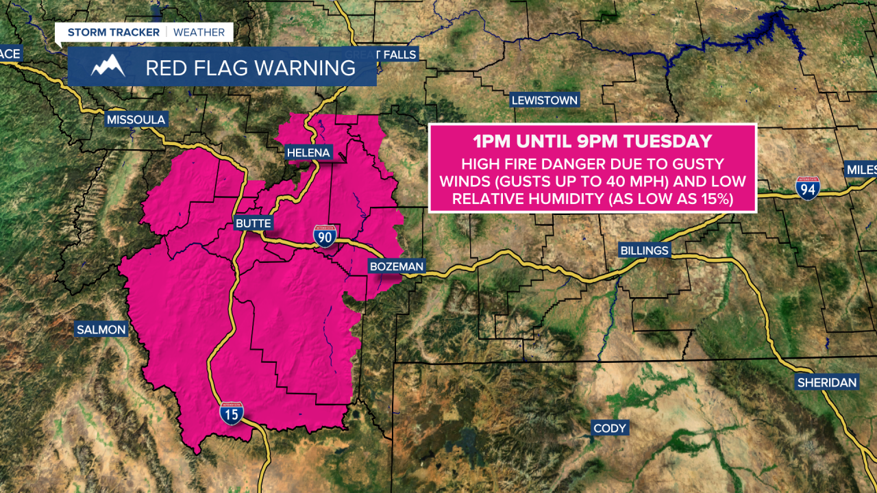
A RED FLAG WARNING is in effect for southwestern Montana from 1pm until 9pm Tuesday.
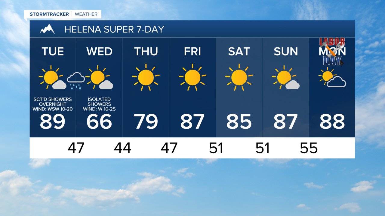
We are going to have mainly clear skies, some haze, little to no wind, and cool temperatures tonight as lows are going to be in the mid to upper 40s and low to mid 50s in most locations.
For tomorrow, we are going to have mostly sunny skies with increasing PM clouds as a cold front begins to approach our area. There is also going to be some haze around again tomorrow, but it should not impact the air quality at all. Most locations are also going to be dry tomorrow, but a couple showers are possible along the western half of the Hi-Line and along the Rocky Mountain Front during the evening. It is also going to be very warm tomorrow as highs are going to be in the 80s and low 90s, and it is going to be breezy tomorrow as well as sustained wind speeds in most locations are going to be between 10 and 20 mph, and wind gusts over 30 mph are possible.
There are then going to be scattered showers and isolated thunderstorms around tomorrow night, especially after midnight and mainly in locations west of Phillips and Petroleum Counties, as a cold front passes through our area. More scattered showers are then expected on Wednesday, generally in north-central Montana, as the storm system associated with the cold front works its way through our area. It is also going to be cold enough for some mountain snow (above 6000 feet) tomorrow night and Wednesday, and light snow accumulations are possible. We are also going to have partly to mostly cloudy skies and little to no haze tomorrow night and Wednesday.
Much cooler temperatures are also expected on Wednesday behind this cold front as highs are only going to be in the mid to upper 50s and low to mid 60s in most locations. It is also going to be windy on Wednesday as sustained wind speeds are going to be between 15 and 30 mph, and wind gusts over 40 mph are possible. Also, this wind is going to be coming out of the west in most locations.
On Thursday, we are going to have mostly sunny skies with some lingering showers around during the morning along the eastern half of the Hi-Line as Wednesday’s storm system leaves our area. It is also going to be warmer on Thursday than it is going to be on Wednesday as highs are going to be in the 70s in most locations. Gusty winds are also expected on Thursday in locations east of I-15 in north-central Montana as sustained wind speeds are going to be between 10 and 25 mph, and wind gusts up to 40 mph are possible.
We are then going to have superb weather for Friday and Labor Day weekend as we are going to have lots of sunshine and dry conditions Friday, Saturday, and Sunday, and we are going to have partly to mostly sunny skies and mainly dry conditions on Monday. There is also only going to be a little breeze around on these four days as sustained wind speeds are going to be between 5 and 20 mph. It is also going to be warm on these four days as highs are going to be in the 80s on Friday; the mid to upper 70s and low to mid 80s on Saturday; and the 80s and low 90s on Sunday and Monday.