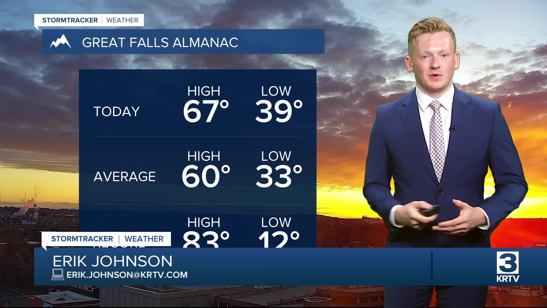

May is kicking off with gorgeous weather in central Montana, although there are still a few lingering rain and mountain snow showers east of I-15. High pressure centered over the southern Oregon/northern California coast will build eastward toward Montana throughout the day, helping to clear out clouds and showers. Winds will remain relatively calm in central Montana, while eastern Montana stays breezy, with sustained winds between 10 and 25 mph. A Lake Wind Advisory is in effect for Fort Peck Lake until 8:00 p.m. this evening.

As the high pressure ridge shifts further east, temperatures will continue to climb. It will feel summer-like, with daytime highs in the 70s and low 80s on Friday, and upper 70s to low 80s on Saturday, accompanied by abundant sunshine.

A Canadian cold front will drop into the area on Sunday. Ahead of it, there could be some stronger thunderstorms with some instability. The main risks will be strong wind gusts and hail.
Cooler weather will settle in as a trough moves into the West. A stronger low pressure system will pass to the south into Utah and Colorado, so most of the heavier precipitation will remain off to the south. Temperatures drop from the 60s on Sunday to the 50s on Monday.
By Tuesday and Wednesday of next week, high pressure will build back in. Sunshine will return, and temperatures will warm back above average.


