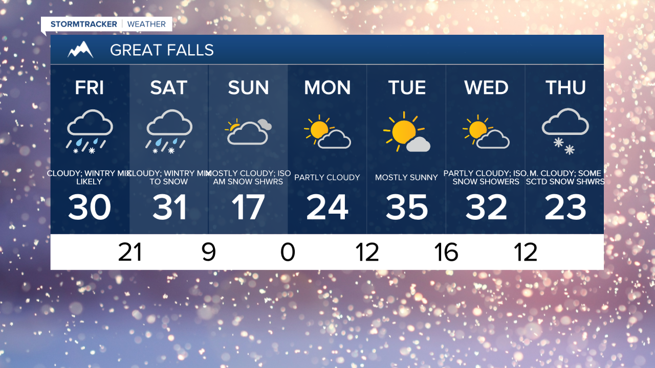
As of 8:30am, snow and freezing rain is overspreading central Montana. Road conditions will begin to deteriorate throughout the morning. The best chance for a glaze of ice is going to be for areas between Great Falls and Helena and between Great Falls and Lewistown. These areas could see up to a tenth of an inch of ice.


A strong low pressure remains anchored off of the West Coast, and southwest flow is drawing some of that moisture into the area, which is leading to several rounds of moisture today and Saturday. However, warm air has moved in aloft, bringing the potential for freezing rain later throughout the day.
A second round of precipitation will arrive tomorrow with more snow and freezing rain accumulation expected. A Winter Storm Watch is in effect for the Rocky Mountain Front and parts of the Hi-Line for Saturday and a Winter Weather Advisory is in effect for the rest of north central Montana.


Behind the storm, a cold airmass will settle in for the entire area. Temperatures will only reach the 10s and 20s on Sunday. In many areas, temperatures could fall below zero on Monday morning.

Calmer weather with sunshine to start of the next work week. It will start to warm up for the first half of the work week, with high temperatures in the low to mid 30s. Another drop in temperatures is anticipated by Thanksgiving Day. That is also the next chance for snow showers in central Montana.


