


The biggest statewide snowstorm of this winter so far is set to impact Montana from Sunday (2/2/2025) through Wednesday (2/5/2025).
An upper-level trough located over the eastern Pacific and Pacific Northwest will maintain a persistent stream of mid- and upper-level moisture over our area for the next several days, while an arctic air mass takes up residence at the surface.
This moisture will override the arctic air, which will lead to that moisture getting squeezed out over Montana in the form of snow. This snow will generally be light in nature, but may be heavy at times.
The snow will not be falling constantly over the next several days, but will instead come in multiple waves. The first wave of scattered snow will impact our area Sunday morning through Monday morning. Lighter snow amounts are expected with this first wave of snow.
The second wave of snow, which will be more widespread, will then impact the state later Monday through Wednesday morning. This is when we will see the bulk of the snow accumulation with this snowstorm.

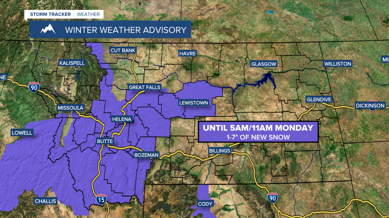
Winter weather alerts are in effect for a lot of Montana through Tuesday or Wednesday depending on your exact location. Snow totals will range greatly throughout the state, with the lowest snow amounts along the Hi-Line and the highest snow amounts in central and southern Montana. A large swath of 6-18" of snow is expected in the lower elevations in central and southern Montana.

No surprise, some of the mountains will see even higher snow amounts as up to 3 feet of snow is possible, especially in the island mountain ranges in central and southern Montana.

This snow will create difficult travel conditions, so please use extreme caution when driving and consider delaying travel if possible.

The wind won't be bad with this storm, but it will be a bit breezy at times (gusts up to 35 mph), which will cause there to be some blowing and drifting snow.
It is also going to be bitterly cold for the next several days with highs only in the -0s, 0s, and 10s, so make sure you bundle up when outdoors.
Stay safe everyone, and if you have any snow reports, please share them with us by sending an email to weather@krtv.com.
