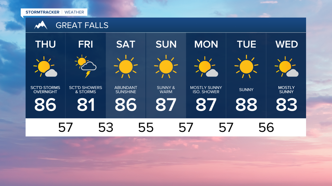
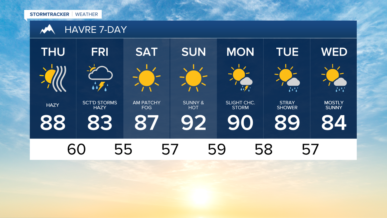
On Thursday, sunshine will prevail across much of central and eastern Montana. However, smoke from Canadian wildfires is going to drift into the region throughout the next couple of days, creating hazy skies and leading to mostly moderate levels of air pollution. Denser smoke arrives by Friday morning, potentially leading to unhealthy air quality for the Hi-Line.
As the day progresses, a disturbance will approach western Montana, bringing clouds and triggering showers and thunderstorms west of the Continental Divide. While these storms will lose steam as they cross the Continental Divide into central Montana after sunset, a few nocturnal thunderstorms may still linger throughout the area on Thursday night.
With some moisture and instability on Friday, a second round of showers and thunderstorms will form in the afternoon, particularly along the Hi-Line where the chance for a stronger storm is highest. Gusty winds will be the main threat with these storms.
Behind the system, high pressure will strengthen leading to a warmer and drier weekend. Temperatures could flirt with 90° in some spots Sunday afternoon.Looking ahead to next week, widespread rainfall or severe weather is not anticipated; however, daily isolated showers and thunderstorms, especially in higher terrain, remain a possibility.