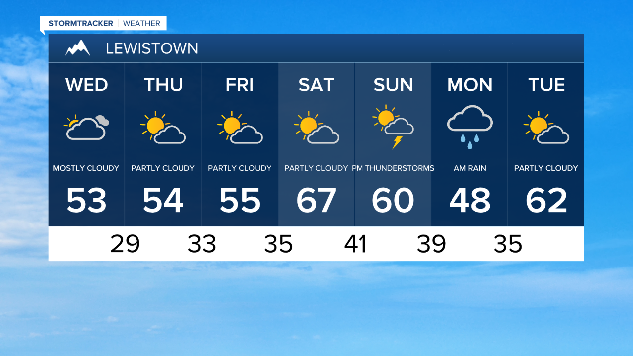
We're basking in sunshine through the rest of the workweek before showers arrive Saturday afternoon into Sunday. After a cold start (20° in Great Falls), a warming trend begins today, with temperatures climbing into the mid and upper 50s during the afternoon. We'll enjoy light winds and mostly sunny skies, making for a pleasant spring day.
This beautiful spring weather will only get better over the next couple of days. However, winds will be a bit stronger on Thursday, ranging from 10 to 25 mph. A weak disturbance in southern Montana could bring a few widely scattered rain and mountain snow showers to the Helena area and the higher elevations in central Montana.

By Friday, temperatures will warm into the upper 50s and low to mid 60s. It will be fairly breezy across the plains, with winds potentially gusting up to 40 mph.
A storm system will approach the region during the day on Saturday, bringing increasing clouds ahead of its arrival. By the evening, scattered showers and thunderstorms will develop in central Montana. It will also be quite warm, with daytime highs in the 60s and low 70s in most areas.
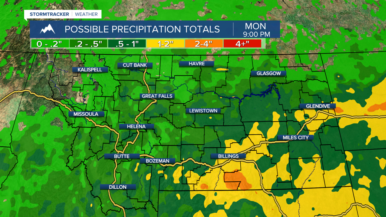
The main impact from the storm will occur Sunday night into Monday, bringing widespread rain showers, embedded thunderstorms, and mountain snow. Right now it looks like the storm will drop between 0.25" to 0.75" of rain on central Montana and 0.1" to 0.3" on the Hi-Line. The heaviest precipitation is likely to be in eastern Montana. Keep checking back for updates on the progression of this system!