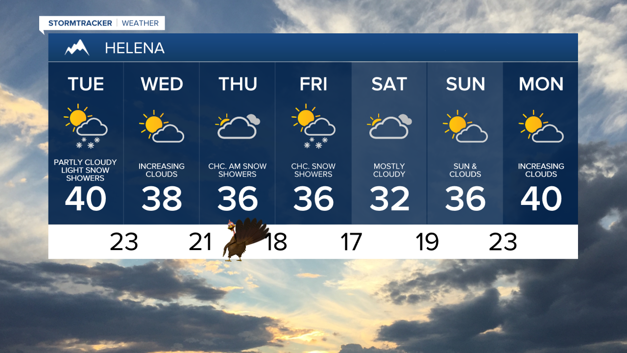
Happy Tuesday! An upper-level low that has been situated just off the West Coast is finally moving inland. Moisture is streaming into Montana, leading to light snow showers, particularly in eastern and southwest Montana throughout the day. Most accumulations will be minimal, primarily affecting mountain passes and higher terrain.

A frigid airmass remains entrenched over north-central Montana, but southwest winds are expected to warm up much of the region, with the exception of the Hi-Line. High temperatures on the Hi-Line will only reach the 10s and 20s, while the rest of the area warms into the mid and upper 30s to low 40s.

As the low pressure shifts east of the area tonight, northwest flow will usher in a quick return of colder air. Many areas will drop into the 0s and 10s. This will likely cause many areas to dip back into the single digits and teens. Additionally, dense fog may form along the Milk River and the Missouri River upstream from Great Falls.

Several disturbances will traverse central and eastern Montana over the coming days, each bringing a chance of light snow, particularly for regions east of I-15. The main periods of snowfall are expected from Wednesday night into early Thanksgiving morning, and from Thursday night through Saturday. While snowfall totals are expected to remain light, generally ranging from a dusting to 3 inches, travel conditions may become slick at times, especially during Thanksgiving morning.

Temperatures will gradually slip closer to the weekend. By Saturday, high temperatures will fall into the 0s for the Hi-Line and the 10s and 20s for the rest of central Montana. Overnight lows will also drop below zero for the Hi-Line and into the 0s for the remainder of the area.

Meanwhile, a high pressure ridge is building off the west coast, which is expected to amplify and move east early next week. Temperatures will trend above normal, with the exception of mountain valleys where strong inversions likely form. Overall, the upcoming week looks to be drier.
Before you hit the road, check the Montana Department of Transportation website - dozens of webcams from across the state can be viewed by clicking here. You can also click here for a map of road conditions across the state; it highlights road conditions, road closures, and construction activity.


