

Good Tuesday morning! We're starting off the day with areas of dense fog, particularly in the plains just east of the Rockies and in Cascade County, where visibility has dropped to as low as half a mile in some locations. Today is going to be the coldest day of the week, with high temperatures ranging from the upper 10s on the Hi-Line to mid 20s across central Montana. The Helena area will see somewhat milder temps, reaching the mid to upper 30s.
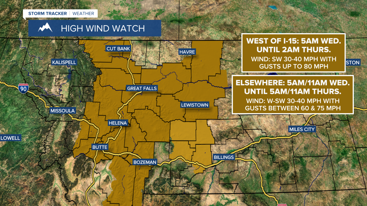
Tonight, a warm front will lift north, bringing light snow to areas north of Great Falls. The more significant impact will be strong winds behind the front starting early Wednesday morning. Winds will be strongest Wednesday afternoon and evening, with widespread gusts of 50-60mph across the plains and potentially reaching 70-80mph west of I-15. If you have any loose items or holiday decorations outside, make sure they’re secured, as they could easily become projectiles. Temperatures will warm considerably on Wednesday with highs into the 40s and 50s!

The milder temperatures will continue throughout the rest of the week due to a strong ridge building over the West. We can expect mostly dry conditions and warmer than normal temperatures to persist. Average highs for central Montana are typically in the mid-30s, but we’ll be well above that all the way through Christmas, with temperatures consistently in the 40s and 50s. It does look like it will be somewhat unsettled next week, especially in the mountains.
