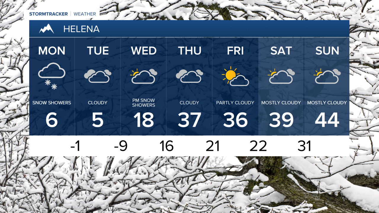
It’s been a snowy and frigid start to Presidents' Day. Poplar, located on the Fort Peck reservation, dropped to -40° and recorded a wind chill of -65°. Mainly light snow will continue, with areas of moderate snowfall possible in western Montana and the Helena area.
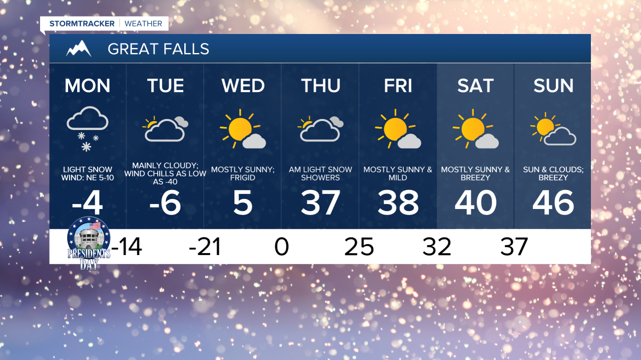
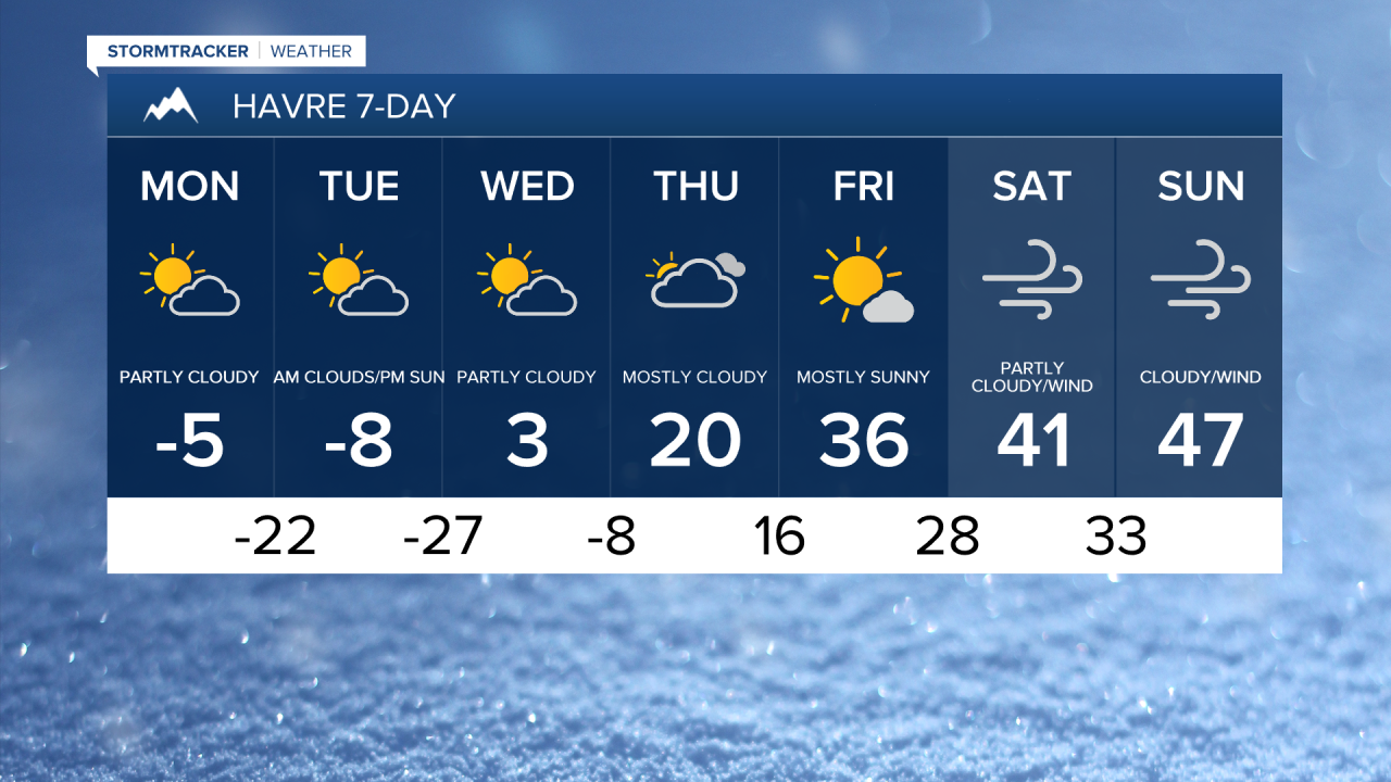
The wind is also expected to pick up slightly for areas east of I-15 and north of Highway 200, leading to blowing and drifting snow. Daytime highs will only reach the -0s in north central Montana, the -10s in eastern Montana, and the 0s and 10s in the Helena area.
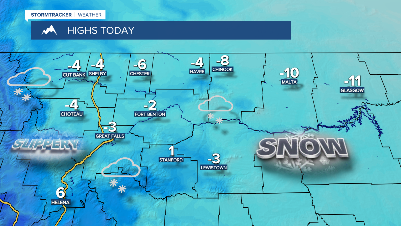
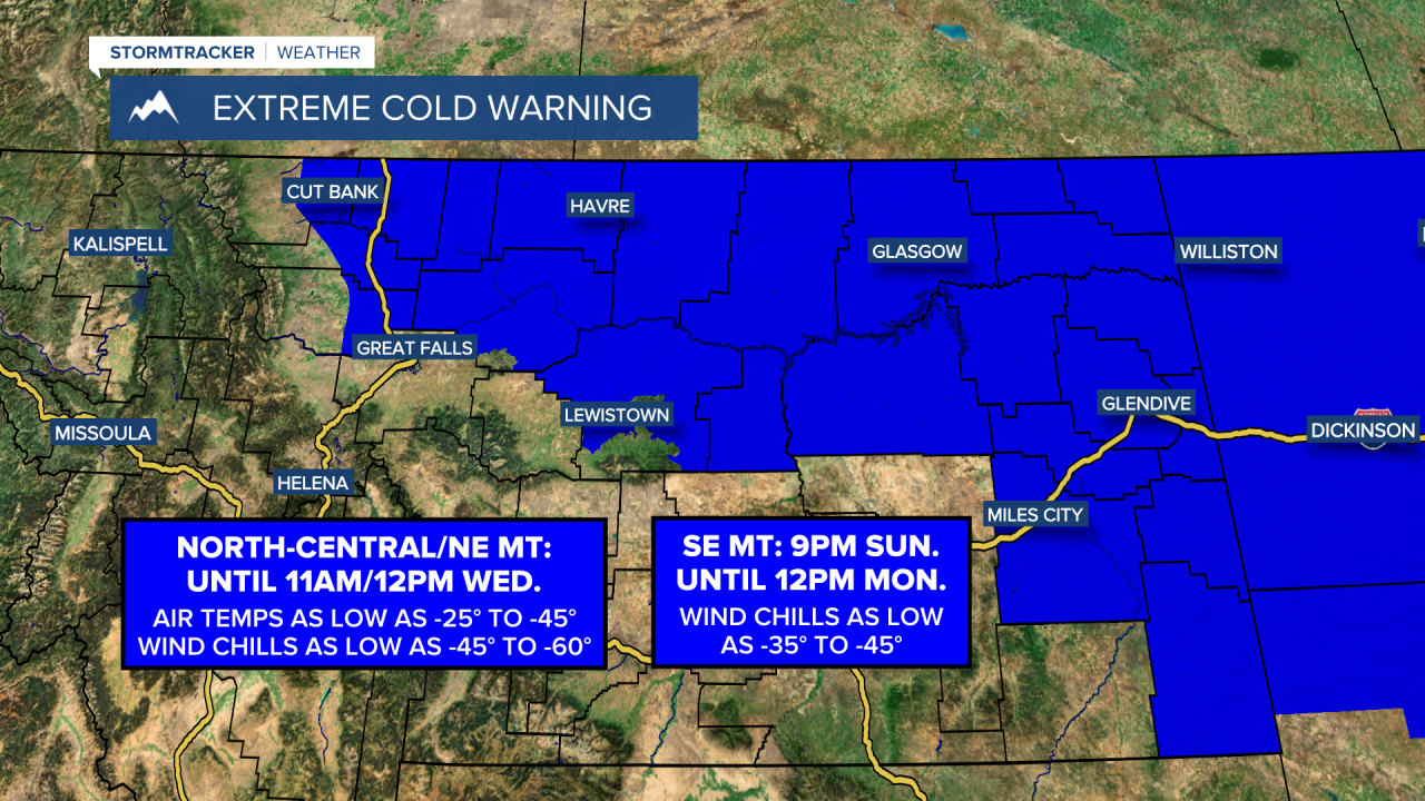
The steadier snow will taper to snow showers tonight. A northwest flow continues to usher in a bitterly cold airmass to Montana, which will persist for the next couple of days. Temperatures are expected to plummet into the -30s and -20s for the Hi-Line east of Havre, the -10s for north central Montana, and the -0s in the Helena area. Wind chills may once again drop to between -50° and -30° by Tuesday morning. Frostbite can form in minutes on exposed skin in these conditions.

Partly to mostly cloudy skies are expected as we head into Tuesday, along with continued bitterly cold temperatures. Daytime highs will range between -10° and 0° across north central and eastern Montana, with single-digit temperatures for the Helena area. There will be less cloud cover on Tuesday night, allowing temperatures to plummet even further. Most areas will drop into the -20s and -10s, with wind chills ranging between -50s, -40s, and -30s.
A high-pressure ridge will begin to build off to the west on Wednesday. Temperatures will start to warm, with highs reaching the -0s in northeastern Montana, the 0s in north central Montana, and the upper 10s to lower 20s in the Helena area up to Lewistown. A few light snow showers are possible for the Rocky Mountain Front and areas south of Highway 200 on Wednesday afternoon.
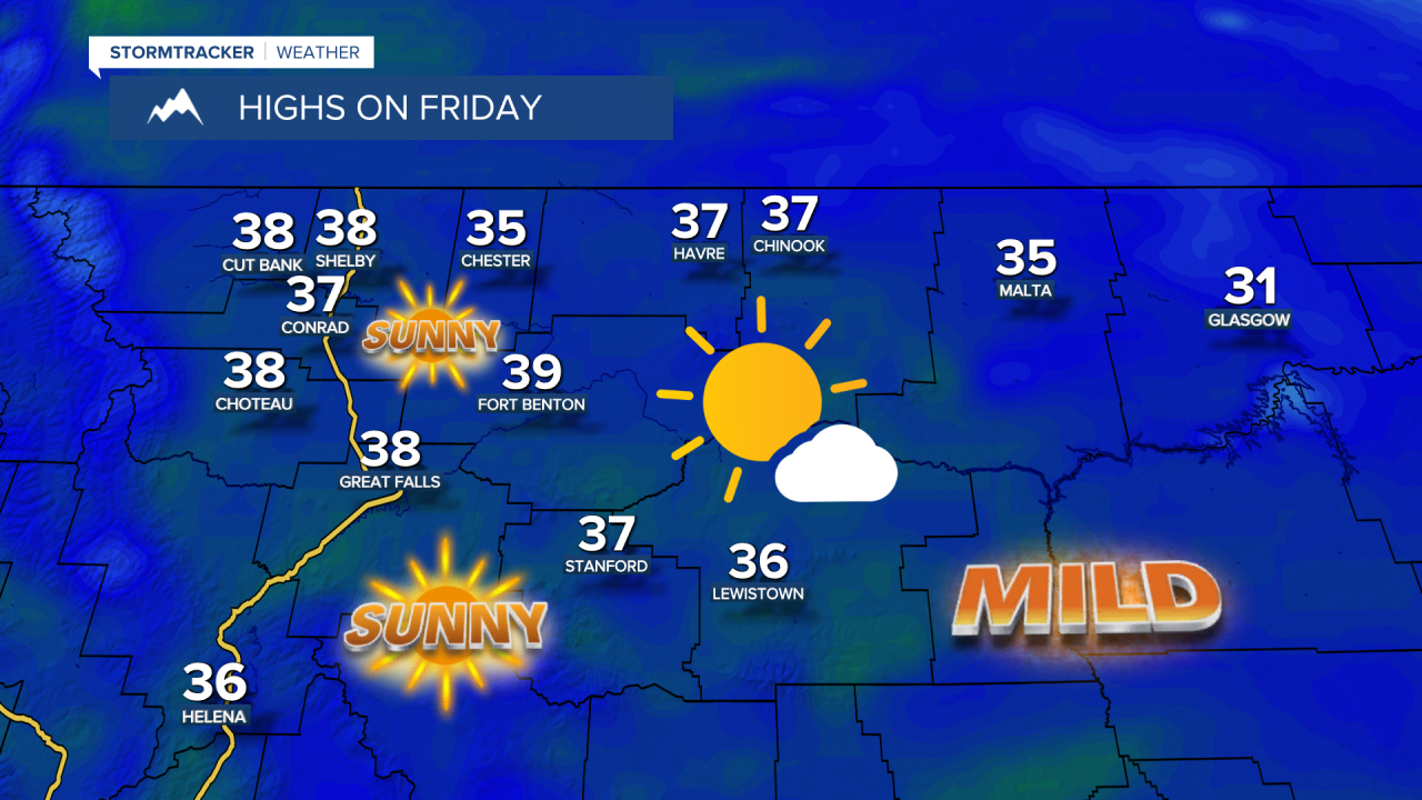
The warming trend will become more pronounced on Thursday as temperatures rise to the 30s in most areas. Then, on Friday and throughout the weekend, temperatures will spike into the 40s, and even reach the lower 50s in some spots. The milder temperatures will be accompanied by stronger winds and possibly blowing/drifting snow later this week.