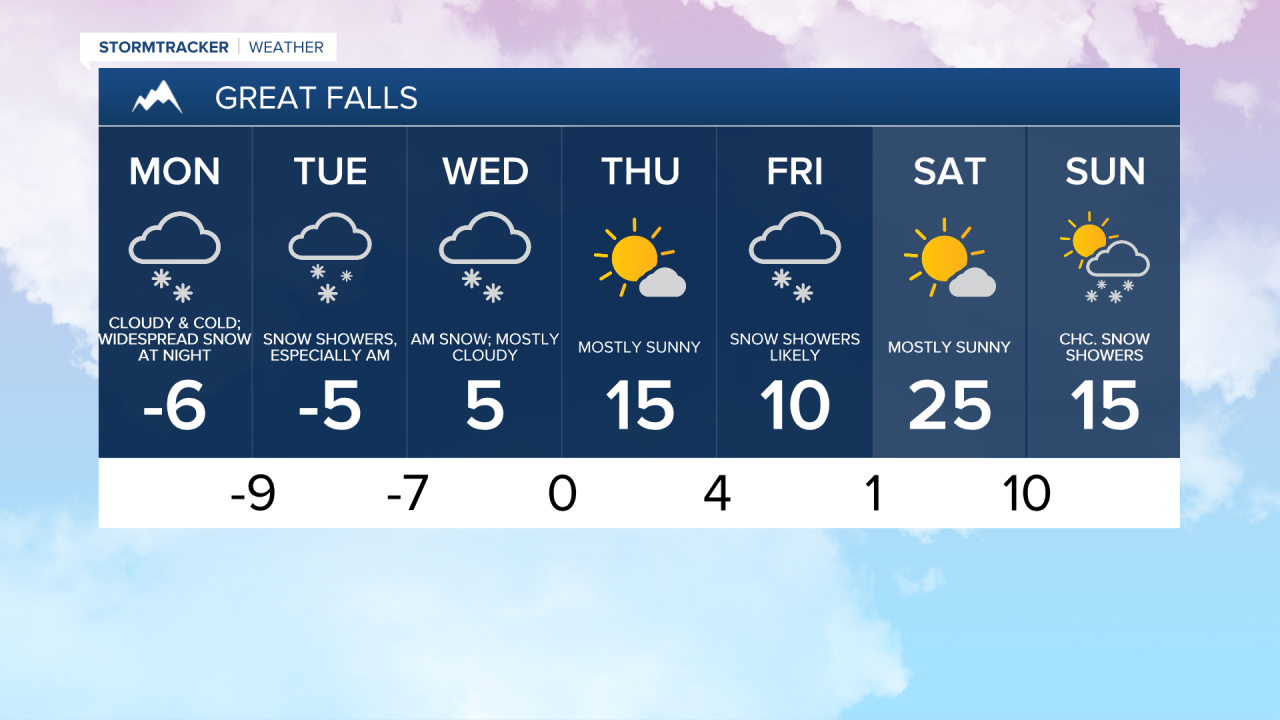
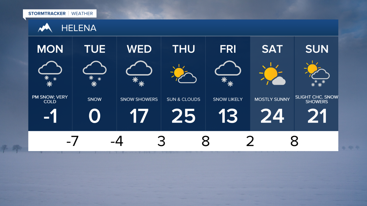
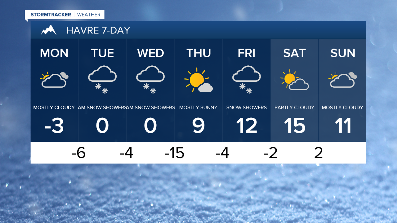
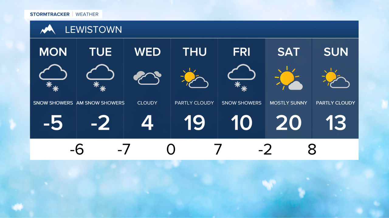
The first week of February is off to a frigid and wintry start. We can expect overcast skies today with a few light snow showers. An east-northeast breeze will be sustained at 5 to 15 mph. Daytime highs will range from the -0s to the -10s, while wind chills will be in the -20s to -30s.

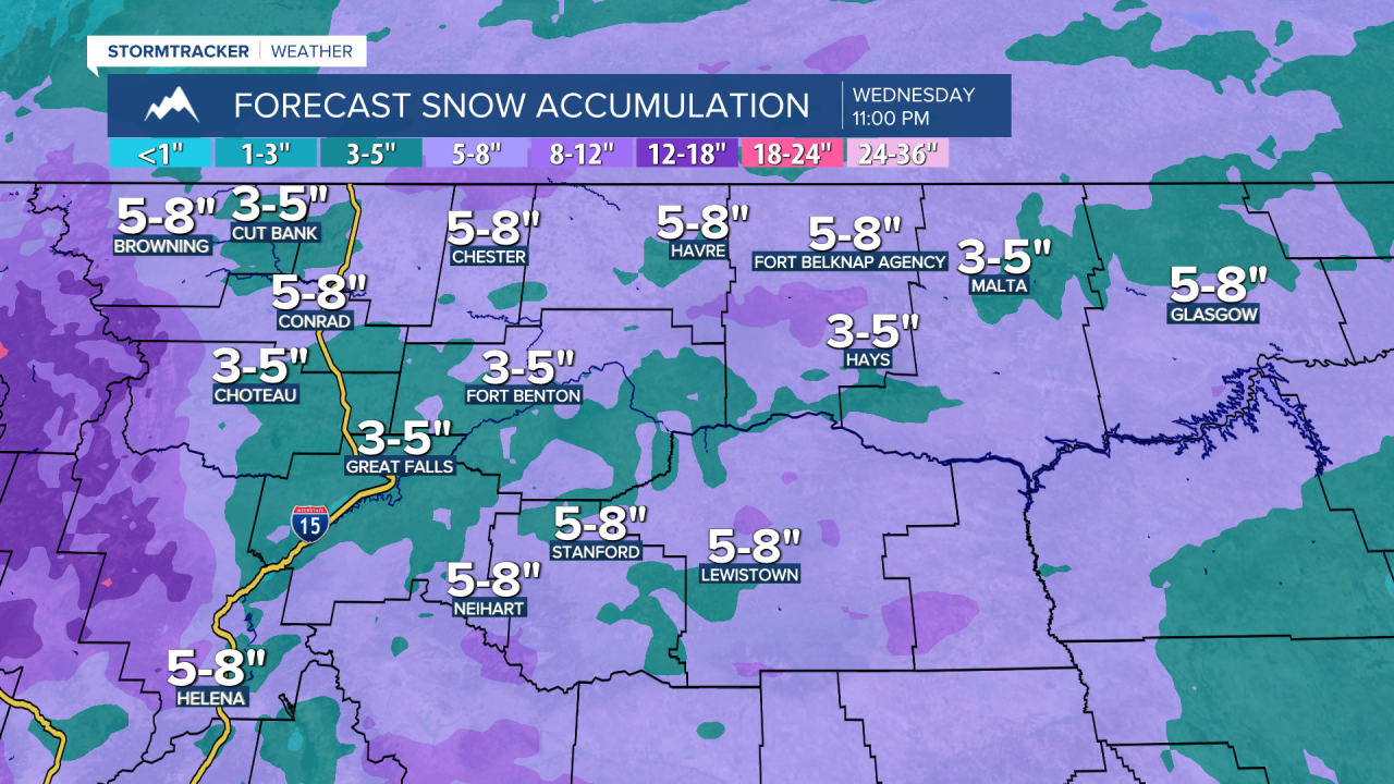
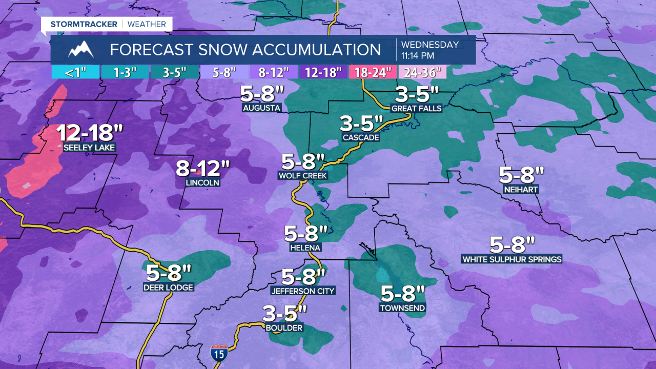
An upper-level low is currently centered near Seattle, directing moisture towards Montana later tonight. Widespread snow is expected to develop across the area this evening, starting in the Helena area around 5:00 PM, then spreading to the rest of central Montana between 6:00 PM and 8:00 PM, and finally reaching the Hi-Line between 9:00 PM and 11:00 PM. Temperatures will once again drop into the -0s to the -10s. An EXTREME COLD WARNING is in effect for the Hi-Line through Tuesday at 11:00 AM, where wind chills could plummet to as low as -40 degrees. Cold Weather Advisories are in effect for the rest of the area through 11:00 AM Tuesday, where wind chills may also drop to -35 degrees.
The snow wraps up early Tuesday morning, but be prepared for a very slippery morning commute. Another wave of Pacific moisture will lead to snow developing over the Continental Divide before spreading east during the overnight hours. This will likely be the timeframe for the heaviest snowfall rates. Daytime highs on Tuesday will again only reach the -0s.
A northerly breeze will continue to create dangerous wind chills from Tuesday night into Wednesday morning, with wind chills potentially dropping as low as -30 degrees across central Montana. The snow will end by the afternoon, but it will still be a slow and snowy Wednesday morning commute. However, temperatures will rise slightly, with daytime highs in the -0s and 0s on the Hi-Line, 0s across central Montana, and up to the 10s in the Helena area.

A brief break from precipitation is expected on Thursday. Temperatures will continue to climb, with daytime highs in the 0s to 10s on the Hi-Line, 10s in central Montana, and low to mid 20s in the Helena area. However, this reprieve will be short-lived, as another disturbance will bring light accumulating snow to the area Thursday night into Friday.
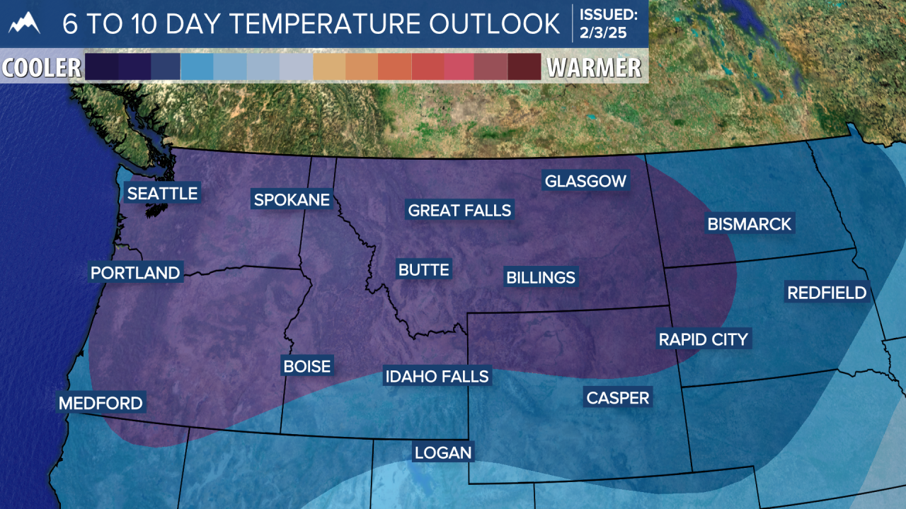
As we head into the upcoming weekend, quieter but still cold conditions will settle in. Expect mostly sunny skies on Saturday, with high temperatures in the low to mid 10s on the Hi-Line from Havre to Glasgow and the low to mid 20s across the rest of the area. A few snow showers are possible on Sunday, with colder temperatures and highs reaching the low to mid 10s.