A strong high pressure ridge off of the Pacific Coast will continue to dictate our forecast as we near the weekend.
This system will help to draw moisture into the state over the next few days.
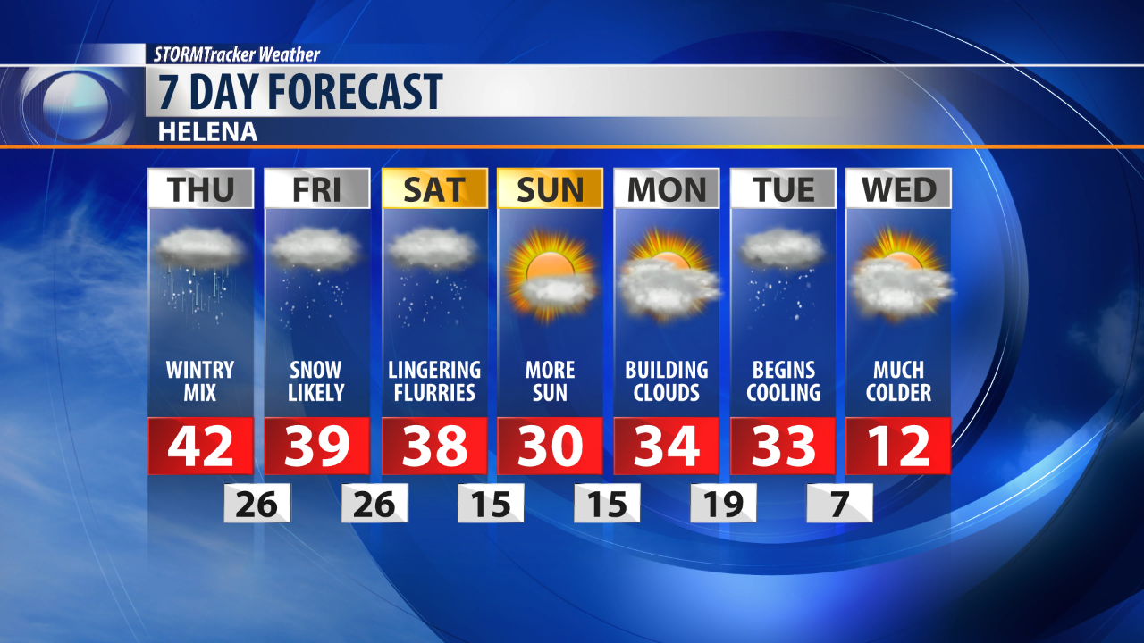
Thursday and Friday will present the best chances of snow accumulation in our area.
The mountains and Southwestern Montana are expected to catch the brunt of the snow.
Most of Central Montana will see around 1-3 inches of accumulation.
The mountains above 5,500 feet on the other had will likely well over 10 inches.
It's not out of the question for some areas above 7,000 feet to pick up two feet.
Spotty flurries and colder temperatures will linger this weekend.
Next week looks to start out a bit breezy with temperature in the high 30s.
Arctic air is expected to begin invading late Tuesday.
This will open the door for more snow and very cold temperatures.


