We had an incredibly busy Father's Day with 116 storm reports across Montana on Sunday! A confirmed tornado was spotted north of Roundup, and two funnel clouds were documented—one near Vaughn and another near Geraldine.

The largest hailstone measured 3.5 inches in diameter near Petrolia Lake in Petroleum County. The strongest wind gust recorded was 81 mph in Miles City. The heaviest rainfall was 1.32 inches in under 90 minutes, also in Miles City.

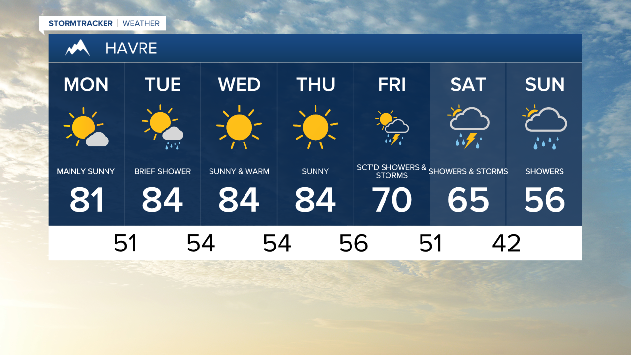
One more stormy day is in the forecast for today, with the higher risk for severe thunderstorms shifted further southeast. Scattered showers and thunderstorms will develop over the mountains of central Montana this afternoon. A more organized severe weather event is expected as the storms spread east during the evening. Damaging winds, large hail and isolated tornadoes likely in the stronger thunderstorms.


Outside of Judith Basin and Fergus counties, mainly cloudy skies and isolated thunderstorms are expected throughout the day. Temperatures will top out in the 70s and lower 80s.

The threat for isolated showers and thunderstorms will carry over into Tuesday, however the severe threat comes to an end. A weak area of high pressure will bring a couple of calmer, nicer days on Wednesday and Thursday. High temperatures will be in the 80s for most towns, with abundant sunshine.
High pressure shifts east by Friday, placing Montana back under southwest flow, which is prime for severe weather. More strong to severe thunderstorms are expected on Friday and Saturday, with similar threats to this weekend’s storms, except that flooding could become a more of an issue.
By Sunday, an upper-level low pressure system moves directly over Montana. This will bring a significant cooldown dropping high temperatures into the 50s and 60s, and snow levels could get as low as 6,000 feet.. There may be accumulating snowfall for areas above 7000 feet. The cooldown will be short-lived as the system departs the area on Monday.