There is quite a temperature difference across Great Falls this morning! As of 10:45 AM, the temperature at the airport is 30°, while it is only 7°F at Malmstrom AFB. A warm front is slowly advancing northeast across central Montana, but some colder air is sinking into the river valleys. Eventually, the milder air will win out, eroding the cold air. However, places like Fort Benton and Havre may take longer to warm up today.

Despite this, temperatures are expected to rise significantly, with daytime highs reaching the upper 20s to 30s in many locations. The Hi-Line east of Havre will remain chilly, with high temperatures only in the single digits and teens. As temperatures increase, winds will also pick up, with sustained speeds of 10 to 20 mph gusting up to 35 mph in some areas. For the Rocky Mountain Front, sustained winds will be between 25 to 35 mph, with gusts exceeding 50 mph.

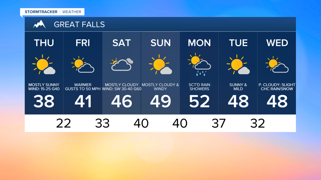
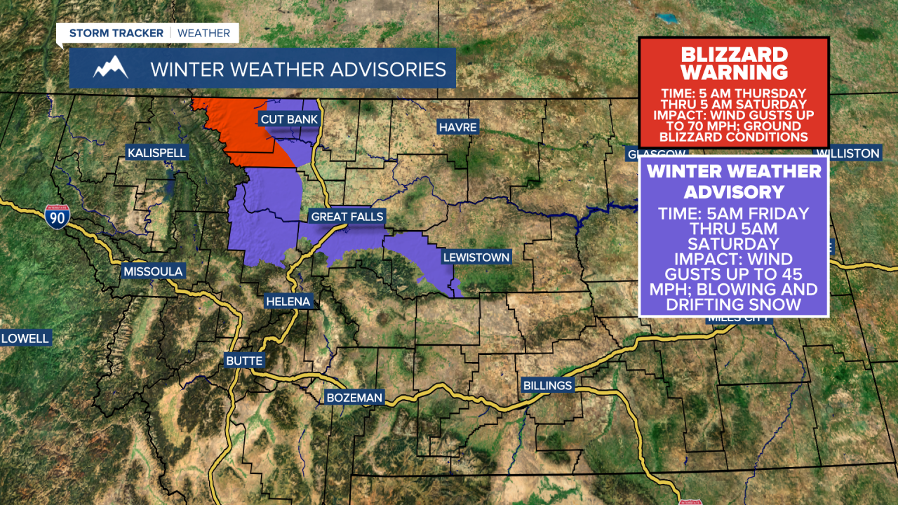
Heading into Friday, temperatures continue to climb, with highs reaching the 30s and 40s for everyone and mostly sunny to partly cloudy skies. However, winds will remain strong, with gusts reaching 60 to 70 mph along the Rocky Mountain Front. The National Weather Service has issued a Blizzard Warning for western Glacier and Pondera counties, including the Blackfeet Nation, where ground blizzards and road closures are possible.
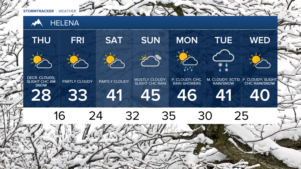
The weekend is shaping up to be pleasant in terms of temperatures, with most areas reaching the upper 30s and low to mid-40s on Saturday, and highs in the 40s and lower 50s on Sunday. It will remain very windy throughout the weekend, with sustained winds between 15 and 35 mph and gusts over 50 mph. Even stronger winds are expected along the Rocky Mountain Front. Saturday will be mostly dry, while Sunday may bring more clouds and some isolated rain or snow showers.

High pressure will continue to influence our weather next week, although a few weak disturbances will move through, bringing stronger winds and unsettled weather early in the week. We'll have especially mild daytime highs on Monday, reaching the 40s and low to mid-50s, before cooling to the 40s and upper 30s on Tuesday and Wednesday.