Windy conditions are still occurring across Central Montana this morning.
Along the Rocky Mountain Front, a Blizzard Warning is still in effect and gusts have clocked in as high as 94 MPH.

Areas along the Rocky Mountain Front highlighted in orange below are under a Blizzard Warning until 3 PM.
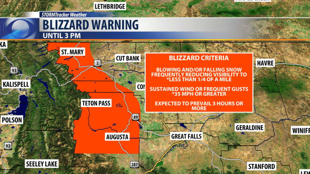
Criteria for issuing a Blizzard Warning was met yesterday afternoon, and extreme driving conditions have prompted road closures by the Montana Department of Transportation.
Areas of blowing and drifting snow will reduce visibility along the Rocky Mountain Front and in areas across North Central Montana.
Downsloping from the wind coming off the Rockies is keeping North-Central Montana much warmer than the rest of the state.
Melting snow occurred in these areas yesterday, and overnight refreezing has creating slick spots for our morning commute.
Wind will become much calmer this afternoon.
We track light snow moving in a little later this evening.
Snow is expected to last through Wednesday afternoon, and most of Central Montana will pick up 1-2″ by the time snow moves out.
Temperatures rebound again Thursday with much more sunshine in the forecast to end the week and begin the weekend!
Montana Department of Transportation resources:
- Road conditions map
- MDT webcams across Montana
- Non-MDT webcams across Montana
- Road conditions mobile app
- Reported crashes/slide-offs
STORMTracker Weather resources:
