Warmer weather sticks around for one more day.
More clouds and breezy conditions also stay around , but we will not be quite as windy as yesterday.
We are tracking a cold front that will make its way in from Canada later tonight.
This will initially bring rain showers through Central Montana, but these rain showers will quickly turn into snow showers by the time we are heading out the door for our morning commute.
Temperatures will also take a big drop.
Highs for Friday will be observed as the rain moves in during very early hours of the day (around 1 am-3 am).
Temperatures start dropping below freezing by 5-6 am which is when we will see rain turn to snow.
Friday afternoon we will have widespread snow showers and much colder weather.
A Winter Weather Advisory is in effect for much of the state until Friday evening.
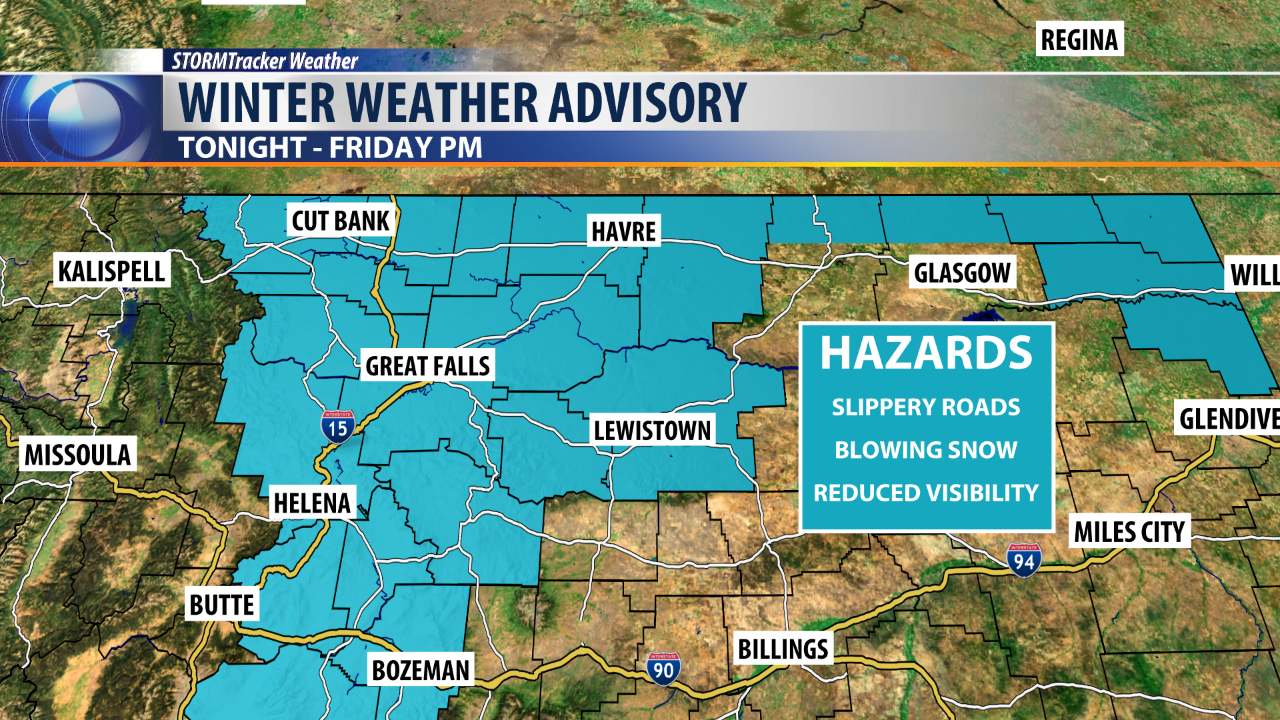
One to 3 inches are expected across Northeast, and North Central Montana with higher elevations receiving closer 5 to 8 inches.
In Central Montana, more snow is expected across Great Falls to Lewistown with 2-4 inches in lower elevations and close to a foot in upper elevations through Kings Hill Pass.
Helena and other lower elevations in the southwest are expected 1-3 inches.
Snow will clear out by Friday evening.
